You are here: Home > Network List > US - United States National Seismic Network Stations List
> Station AMTX Amarillo, Texas, USA > Earthquake Result Viewer
AMTX Amarillo, Texas, USA - Earthquake Result Viewer
*The percent match for this event was below the threshold and hence no stack was calculated.
| Earthquake location: |
Kodiak Island Region, Alaska |
| Earthquake latitude/longitude: |
56.9/-154.1 |
| Earthquake time(UTC): |
2012/09/18 (262) 01:44:50 GMT |
| Earthquake Depth: |
39 km |
| Earthquake Magnitude: |
5.5 MB, 4.7 MS, 5.2 MW, 5.1 MW |
| Earthquake Catalog/Contributor: |
WHDF/NEIC |
|
| Network: |
US United States National Seismic Network |
| Station: |
AMTX Amarillo, Texas, USA |
| Lat/Lon: |
34.53 N/101.41 W |
| Elevation: |
1010 m |
|
| Distance: |
41.8 deg |
| Az: |
99.406 deg |
| Baz: |
319.08 deg |
| Ray Param: |
$rayparam |
*The percent match for this event was below the threshold and hence was not used in the summary stack. |
|
| Radial Match: |
46.38143 % |
| Radial Bump: |
400 |
| Transverse Match: |
34.0068 % |
| Transverse Bump: |
400 |
| SOD ConfigId: |
558545 |
| Insert Time: |
2013-09-17 18:50:50.789 +0000 |
| GWidth: |
2.5 |
| Max Bumps: |
400 |
| Tol: |
0.001 |
|
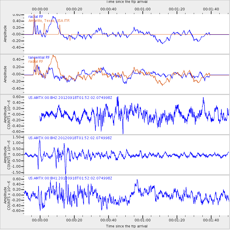
Signal To Noise
| Channel | StoN | STA | LTA |
| US:AMTX:00:BHZ:20120918T01:52:02.074998Z | 4.357288 | 4.866116E-7 | 1.1167764E-7 |
| US:AMTX:00:BH1:20120918T01:52:02.074998Z | 1.2652174 | 2.7936485E-7 | 2.2080383E-7 |
| US:AMTX:00:BH2:20120918T01:52:02.074998Z | 1.9127773 | 2.3128221E-7 | 1.2091435E-7 |
| Arrivals |
| Ps | |
| PpPs | |
| PsPs/PpSs | |


