You are here: Home > Network List > US - United States National Seismic Network Stations List
> Station GLMI Grayling, Michigan, USA > Earthquake Result Viewer
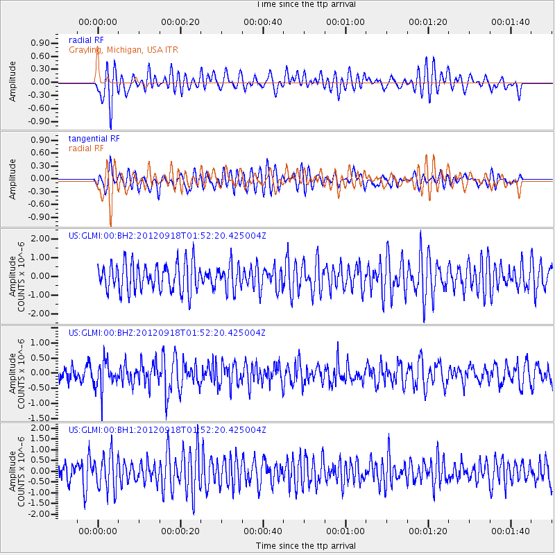
GLMI Grayling, Michigan, USA - Earthquake Result Viewer
*The percent match for this event was below the threshold and hence no stack was calculated.
| Earthquake location: |
Kodiak Island Region, Alaska |
| Earthquake latitude/longitude: |
56.9/-154.1 |
| Earthquake time(UTC): |
2012/09/18 (262) 01:44:50 GMT |
| Earthquake Depth: |
39 km |
| Earthquake Magnitude: |
5.5 MB, 4.7 MS, 5.2 MW, 5.1 MW |
| Earthquake Catalog/Contributor: |
WHDF/NEIC |
|
| Network: |
US United States National Seismic Network |
| Station: |
GLMI Grayling, Michigan, USA |
| Lat/Lon: |
44.82 N/84.62 W |
| Elevation: |
387 m |
|
| Distance: |
43.6 deg |
| Az: |
75.14 deg |
| Baz: |
311.885 deg |
| Ray Param: |
$rayparam |
*The percent match for this event was below the threshold and hence was not used in the summary stack. |
|
| Radial Match: |
54.71583 % |
| Radial Bump: |
400 |
| Transverse Match: |
64.91553 % |
| Transverse Bump: |
400 |
| SOD ConfigId: |
558545 |
| Insert Time: |
2013-09-17 18:51:29.895 +0000 |
| GWidth: |
2.5 |
| Max Bumps: |
400 |
| Tol: |
0.001 |
|
Signal To Noise
| Channel | StoN | STA | LTA |
| US:GLMI:00:BHZ:20120918T01:52:20.425004Z | 1.8999367 | 4.7807634E-7 | 2.5162754E-7 |
| US:GLMI:00:BH1:20120918T01:52:20.425004Z | 1.5271292 | 8.087149E-7 | 5.295655E-7 |
| US:GLMI:00:BH2:20120918T01:52:20.425004Z | 0.9351203 | 6.818378E-7 | 7.2914446E-7 |
| Arrivals |
| Ps | |
| PpPs | |
| PsPs/PpSs | |


