You are here: Home > Network List > US - United States National Seismic Network Stations List
> Station TZTN Tazewell, Tennessee, USA > Earthquake Result Viewer
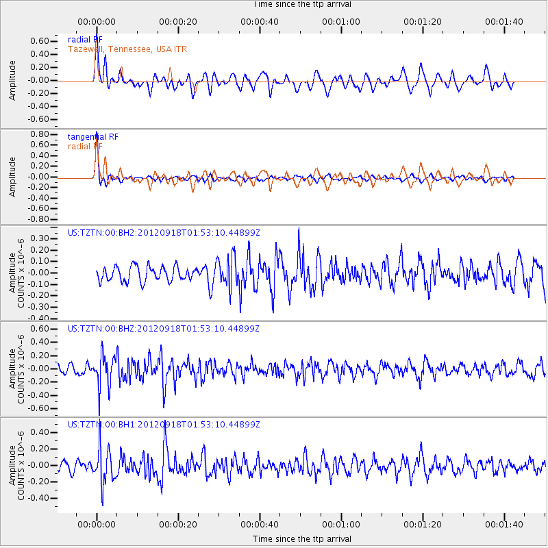
TZTN Tazewell, Tennessee, USA - Earthquake Result Viewer
*The percent match for this event was below the threshold and hence no stack was calculated.
| Earthquake location: |
Kodiak Island Region, Alaska |
| Earthquake latitude/longitude: |
56.9/-154.1 |
| Earthquake time(UTC): |
2012/09/18 (262) 01:44:50 GMT |
| Earthquake Depth: |
39 km |
| Earthquake Magnitude: |
5.5 MB, 4.7 MS, 5.2 MW, 5.1 MW |
| Earthquake Catalog/Contributor: |
WHDF/NEIC |
|
| Network: |
US United States National Seismic Network |
| Station: |
TZTN Tazewell, Tennessee, USA |
| Lat/Lon: |
36.54 N/83.55 W |
| Elevation: |
394 m |
|
| Distance: |
50.0 deg |
| Az: |
82.414 deg |
| Baz: |
317.569 deg |
| Ray Param: |
$rayparam |
*The percent match for this event was below the threshold and hence was not used in the summary stack. |
|
| Radial Match: |
65.73292 % |
| Radial Bump: |
400 |
| Transverse Match: |
92.96811 % |
| Transverse Bump: |
329 |
| SOD ConfigId: |
558545 |
| Insert Time: |
2013-09-17 18:52:38.988 +0000 |
| GWidth: |
2.5 |
| Max Bumps: |
400 |
| Tol: |
0.001 |
|
Signal To Noise
| Channel | StoN | STA | LTA |
| US:TZTN:00:BHZ:20120918T01:53:10.44899Z | 2.460857 | 2.400479E-7 | 9.754647E-8 |
| US:TZTN:00:BH1:20120918T01:53:10.44899Z | 2.4944482 | 2.1755959E-7 | 8.721753E-8 |
| US:TZTN:00:BH2:20120918T01:53:10.44899Z | 2.0832484 | 1.2955114E-7 | 6.2187084E-8 |
| Arrivals |
| Ps | |
| PpPs | |
| PsPs/PpSs | |


