You are here: Home > Network List > US - United States National Seismic Network Stations List
> Station WUAZ Wupatki, Arizona, USA > Earthquake Result Viewer
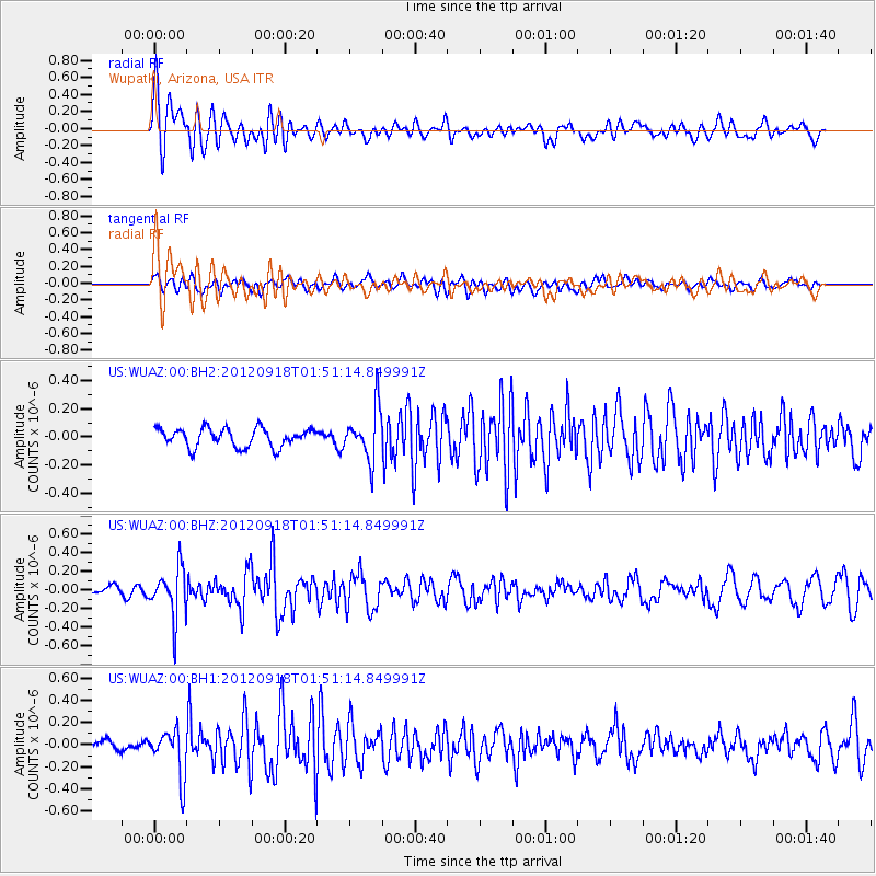
WUAZ Wupatki, Arizona, USA - Earthquake Result Viewer
*The percent match for this event was below the threshold and hence no stack was calculated.
| Earthquake location: |
Kodiak Island Region, Alaska |
| Earthquake latitude/longitude: |
56.9/-154.1 |
| Earthquake time(UTC): |
2012/09/18 (262) 01:44:50 GMT |
| Earthquake Depth: |
39 km |
| Earthquake Magnitude: |
5.5 MB, 4.7 MS, 5.2 MW, 5.1 MW |
| Earthquake Catalog/Contributor: |
WHDF/NEIC |
|
| Network: |
US United States National Seismic Network |
| Station: |
WUAZ Wupatki, Arizona, USA |
| Lat/Lon: |
35.52 N/111.37 W |
| Elevation: |
1592 m |
|
| Distance: |
35.7 deg |
| Az: |
108.363 deg |
| Baz: |
320.379 deg |
| Ray Param: |
$rayparam |
*The percent match for this event was below the threshold and hence was not used in the summary stack. |
|
| Radial Match: |
72.896866 % |
| Radial Bump: |
400 |
| Transverse Match: |
61.157497 % |
| Transverse Bump: |
400 |
| SOD ConfigId: |
558545 |
| Insert Time: |
2013-09-17 18:52:46.328 +0000 |
| GWidth: |
2.5 |
| Max Bumps: |
400 |
| Tol: |
0.001 |
|
Signal To Noise
| Channel | StoN | STA | LTA |
| US:WUAZ:00:BHZ:20120918T01:51:14.849991Z | 3.6764865 | 2.607685E-7 | 7.092873E-8 |
| US:WUAZ:00:BH1:20120918T01:51:14.849991Z | 2.7102206 | 2.1010678E-7 | 7.7523865E-8 |
| US:WUAZ:00:BH2:20120918T01:51:14.849991Z | 2.769844 | 1.8284675E-7 | 6.601338E-8 |
| Arrivals |
| Ps | |
| PpPs | |
| PsPs/PpSs | |


