You are here: Home > Network List > IU - Global Seismograph Network (GSN - IRIS/USGS) Stations List
> Station MAJO Matsushiro, Japan > Earthquake Result Viewer
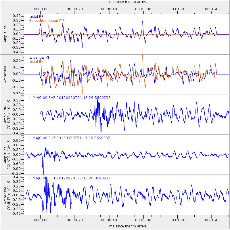
MAJO Matsushiro, Japan - Earthquake Result Viewer
*The percent match for this event was below the threshold and hence no stack was calculated.
| Earthquake location: |
Fiji Islands Region |
| Earthquake latitude/longitude: |
-20.8/-178.5 |
| Earthquake time(UTC): |
2012/09/20 (264) 21:03:42 GMT |
| Earthquake Depth: |
570 km |
| Earthquake Magnitude: |
5.7 MW, 5.3 MB, 5.7 MW |
| Earthquake Catalog/Contributor: |
WHDF/NEIC |
|
| Network: |
IU Global Seismograph Network (GSN - IRIS/USGS) |
| Station: |
MAJO Matsushiro, Japan |
| Lat/Lon: |
36.55 N/138.20 E |
| Elevation: |
405 m |
|
| Distance: |
70.1 deg |
| Az: |
324.054 deg |
| Baz: |
136.983 deg |
| Ray Param: |
$rayparam |
*The percent match for this event was below the threshold and hence was not used in the summary stack. |
|
| Radial Match: |
60.708183 % |
| Radial Bump: |
400 |
| Transverse Match: |
53.890762 % |
| Transverse Bump: |
400 |
| SOD ConfigId: |
558545 |
| Insert Time: |
2013-09-17 18:54:21.033 +0000 |
| GWidth: |
2.5 |
| Max Bumps: |
400 |
| Tol: |
0.001 |
|
Signal To Noise
| Channel | StoN | STA | LTA |
| IU:MAJO:00:BHZ:20120920T21:13:26.869023Z | 5.032441 | 3.6381928E-7 | 7.229479E-8 |
| IU:MAJO:00:BH1:20120920T21:13:26.869023Z | 2.97733 | 1.845763E-7 | 6.1993894E-8 |
| IU:MAJO:00:BH2:20120920T21:13:26.869023Z | 2.129691 | 1.3196353E-7 | 6.19637E-8 |
| Arrivals |
| Ps | |
| PpPs | |
| PsPs/PpSs | |


