You are here: Home > Network List > US - United States National Seismic Network Stations List
> Station LKWY Lake (Yellowstone--Lake), Wyoming, USA > Earthquake Result Viewer
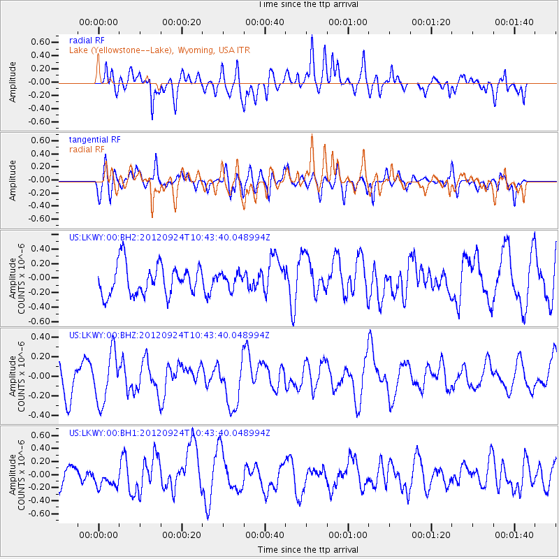
LKWY Lake (Yellowstone--Lake), Wyoming, USA - Earthquake Result Viewer
*The percent match for this event was below the threshold and hence no stack was calculated.
| Earthquake location: |
Tonga Islands |
| Earthquake latitude/longitude: |
-21.2/-174.3 |
| Earthquake time(UTC): |
2012/09/24 (268) 10:31:23 GMT |
| Earthquake Depth: |
10 km |
| Earthquake Magnitude: |
5.7 MB, 5.4 MS, 5.5 MW, 5.5 MW |
| Earthquake Catalog/Contributor: |
WHDF/NEIC |
|
| Network: |
US United States National Seismic Network |
| Station: |
LKWY Lake (Yellowstone--Lake), Wyoming, USA |
| Lat/Lon: |
44.57 N/110.40 W |
| Elevation: |
2424 m |
|
| Distance: |
87.6 deg |
| Az: |
39.974 deg |
| Baz: |
236.992 deg |
| Ray Param: |
$rayparam |
*The percent match for this event was below the threshold and hence was not used in the summary stack. |
|
| Radial Match: |
63.44024 % |
| Radial Bump: |
400 |
| Transverse Match: |
52.519035 % |
| Transverse Bump: |
400 |
| SOD ConfigId: |
558545 |
| Insert Time: |
2013-09-17 19:10:58.957 +0000 |
| GWidth: |
2.5 |
| Max Bumps: |
400 |
| Tol: |
0.001 |
|
Signal To Noise
| Channel | StoN | STA | LTA |
| US:LKWY:00:BHZ:20120924T10:43:40.048994Z | 1.9360796 | 2.6587355E-7 | 1.3732574E-7 |
| US:LKWY:00:BH1:20120924T10:43:40.048994Z | 0.5209962 | 1.17103006E-7 | 2.247675E-7 |
| US:LKWY:00:BH2:20120924T10:43:40.048994Z | 0.48370767 | 1.0179696E-7 | 2.104514E-7 |
| Arrivals |
| Ps | |
| PpPs | |
| PsPs/PpSs | |


