
KEV Kevo, Finland - Earthquake Result Viewer
| ||||||||||||||||||
| ||||||||||||||||||
| ||||||||||||||||||
|
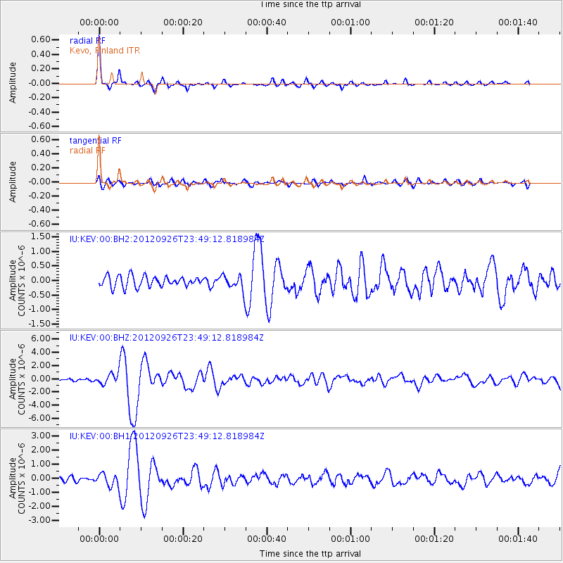
Signal To Noise
| Channel | StoN | STA | LTA |
| IU:KEV:00:BHZ:20120926T23:49:12.818984Z | 3.0567667 | 9.0427784E-7 | 2.9582822E-7 |
| IU:KEV:00:BH1:20120926T23:49:12.818984Z | 2.7391727 | 4.738655E-7 | 1.7299585E-7 |
| IU:KEV:00:BH2:20120926T23:49:12.818984Z | 1.4740013 | 2.7028233E-7 | 1.8336641E-7 |
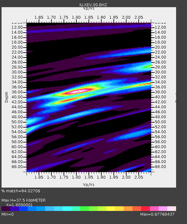
| Arrivals | |
| Ps | 4.8 SECOND |
| PpPs | 15 SECOND |
| PsPs/PpSs | 20 SECOND |

