TEIG Tepich, Yucatan, Mexico - Earthquake Result Viewer
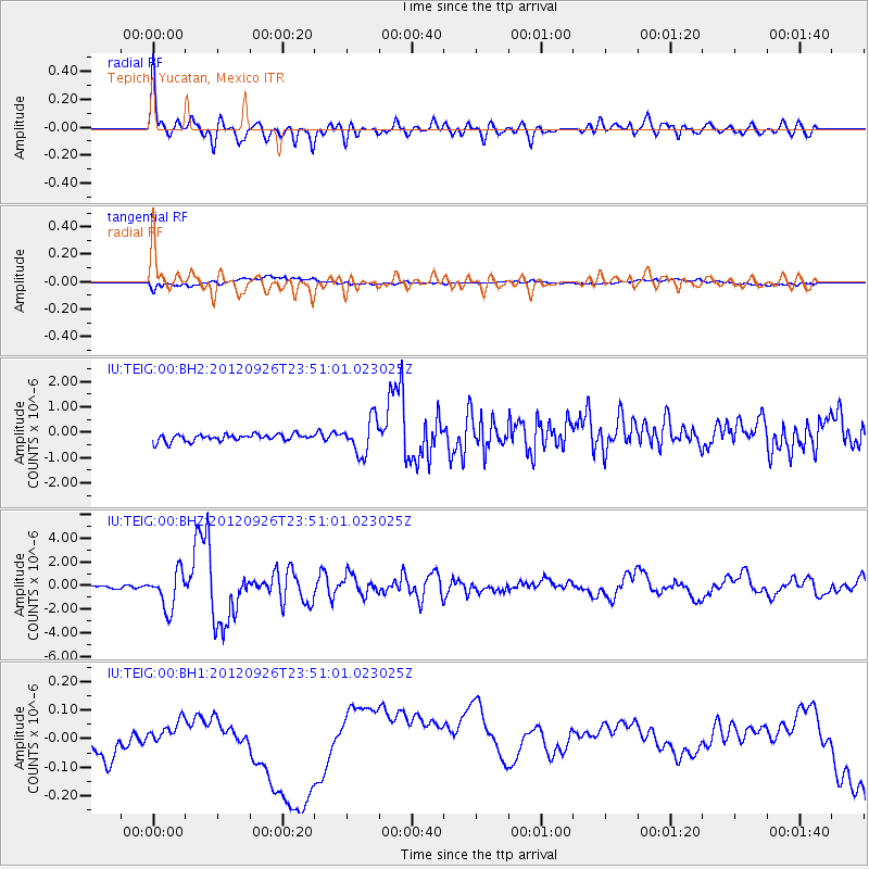
Earthquake location: Andreanof Islands, Aleutian Is.
Earthquake latitude/longitude: 51.6/-178.3
Earthquake time(UTC): 2012/09/26 (270) 23:39:55 GMT
Earthquake Depth: 16 km
Earthquake Magnitude: 6.3 MB, 6.5 MS, 6.4 MW, 6.4 MW
Earthquake Catalog/Contributor: WHDF/NEIC
Network: IU Global Seismograph Network (GSN - IRIS/USGS)
Station: TEIG Tepich, Yucatan, Mexico
Lat/Lon: 20.23 N/88.28 W
Elevation: 40 m
Distance: 74.4 deg
Az: 77.126 deg
Baz: 319.64 deg
Ray Param: 0.052327674
Estimated Moho Depth: 31.0 km
Estimated Crust Vp/Vs: 2.09
Assumed Crust Vp: 5.817 km/s
Estimated Crust Vs: 2.78 km/s
Estimated Crust Poisson's Ratio: 0.35
Radial Match: 84.15758 %
Radial Bump: 400
Transverse Match: 39.910614 %
Transverse Bump: 400
SOD ConfigId: 558545
Insert Time: 2013-09-17 19:23:14.195 +0000
GWidth: 2.5
Max Bumps: 400
Tol: 0.001

Signal To Noise

ChannelStoNSTALTA
IU:TEIG:00:BHZ:20120926T23:51:01.023025Z8.5165161.5623206E-61.8344598E-7
IU:TEIG:00:BH1:20120926T23:51:01.023025Z2.04743088.3141316E-84.0607635E-8
IU:TEIG:00:BH2:20120926T23:51:01.023025Z4.89761926.7483626E-71.3778863E-7
Arrivals
Ps6.0 SECOND
PpPs16 SECOND
PsPs/PpSs22 SECOND