
ACSO Alum Creek State Park, Ohio, USA - Earthquake Result Viewer
| ||||||||||||||||||
| ||||||||||||||||||
| ||||||||||||||||||
|
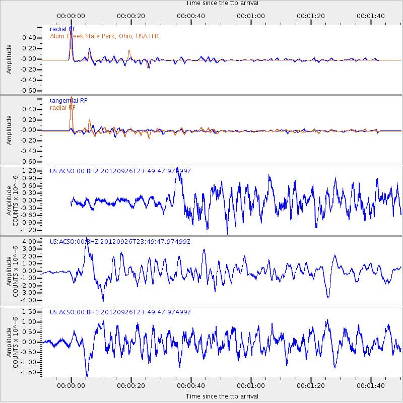
Signal To Noise
| Channel | StoN | STA | LTA |
| US:ACSO:00:BHZ:20120926T23:49:47.97499Z | 7.720443 | 1.0584706E-6 | 1.3709973E-7 |
| US:ACSO:00:BH1:20120926T23:49:47.97499Z | 3.1856883 | 3.3471974E-7 | 1.0506984E-7 |
| US:ACSO:00:BH2:20120926T23:49:47.97499Z | 2.231999 | 2.580049E-7 | 1.1559365E-7 |
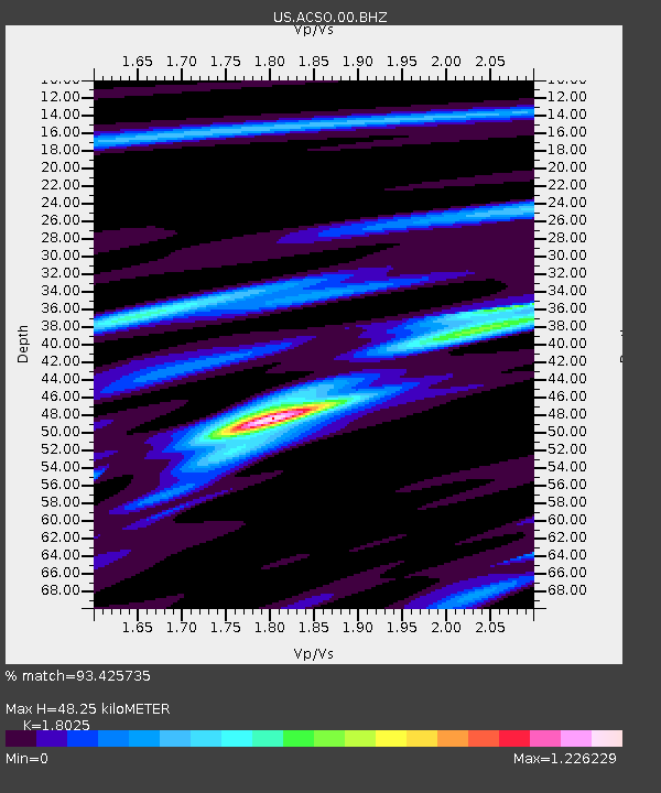
| Arrivals | |
| Ps | 6.2 SECOND |
| PpPs | 20 SECOND |
| PsPs/PpSs | 26 SECOND |

