CBKS Cedar Bluff, Kansas, USA - Earthquake Result Viewer
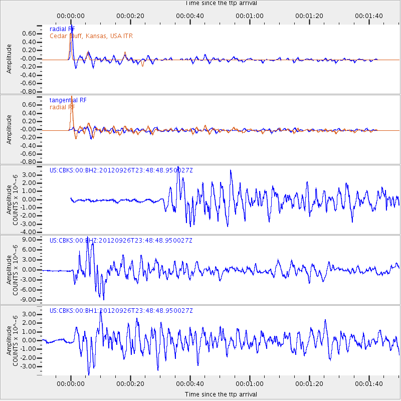
Earthquake location: Andreanof Islands, Aleutian Is.
Earthquake latitude/longitude: 51.6/-178.3
Earthquake time(UTC): 2012/09/26 (270) 23:39:55 GMT
Earthquake Depth: 16 km
Earthquake Magnitude: 6.3 MB, 6.5 MS, 6.4 MW, 6.4 MW
Earthquake Catalog/Contributor: WHDF/NEIC
Network: US United States National Seismic Network
Station: CBKS Cedar Bluff, Kansas, USA
Lat/Lon: 38.81 N/99.74 W
Elevation: 677 m
Distance: 54.2 deg
Az: 70.691 deg
Baz: 311.098 deg
Ray Param: 0.06556535
Estimated Moho Depth: 10.0 km
Estimated Crust Vp/Vs: 1.60
Assumed Crust Vp: 6.483 km/s
Estimated Crust Vs: 4.052 km/s
Estimated Crust Poisson's Ratio: 0.18
Radial Match: 97.4913 %
Radial Bump: 285
Transverse Match: 89.97336 %
Transverse Bump: 400
SOD ConfigId: 558545
Insert Time: 2013-09-17 19:24:33.806 +0000
GWidth: 2.5
Max Bumps: 400
Tol: 0.001

Signal To Noise

ChannelStoNSTALTA
US:CBKS:00:BHZ:20120926T23:48:48.950027Z15.0877811.835963E-61.2168542E-7
US:CBKS:00:BH1:20120926T23:48:48.950027Z7.73246538.3227656E-71.0763405E-7
US:CBKS:00:BH2:20120926T23:48:48.950027Z7.31372937.688371E-71.0512244E-7
Arrivals
Ps1.0 SECOND
PpPs3.8 SECOND
PsPs/PpSs4.8 SECOND