
COWI Conover, Wisconsin, USA - Earthquake Result Viewer
| ||||||||||||||||||
| ||||||||||||||||||
| ||||||||||||||||||
|
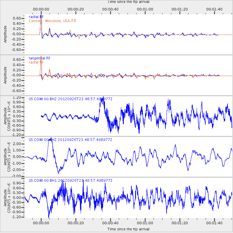
Signal To Noise
| Channel | StoN | STA | LTA |
| US:COWI:00:BHZ:20120926T23:48:57.498977Z | 9.029531 | 1.062023E-6 | 1.1761663E-7 |
| US:COWI:00:BH1:20120926T23:48:57.498977Z | 4.24547 | 4.634904E-7 | 1.0917293E-7 |
| US:COWI:00:BH2:20120926T23:48:57.498977Z | 4.5937767 | 4.641533E-7 | 1.0103958E-7 |
| Arrivals | |
| Ps | 5.0 SECOND |
| PpPs | 15 SECOND |
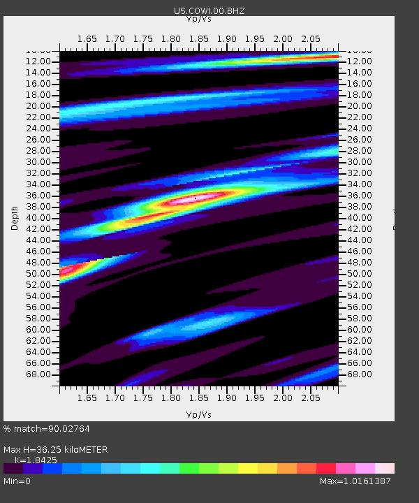
| PsPs/PpSs | 20 SECOND |

