You are here: Home > Network List > II - Global Seismograph Network (GSN - IRIS/IDA) Stations List
> Station TAU Hobart, Tasmania, Australia > Earthquake Result Viewer
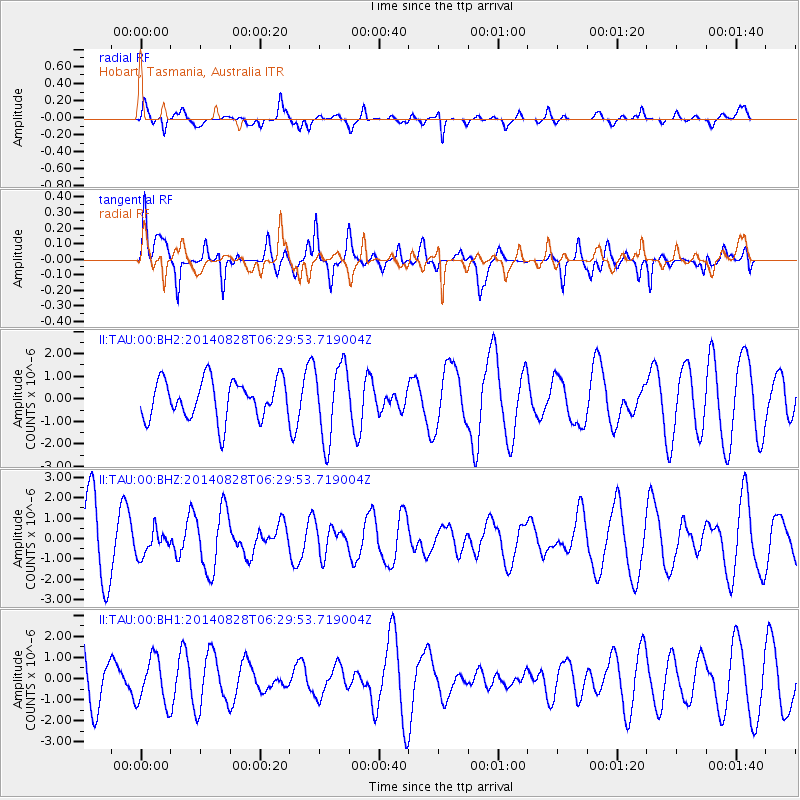
TAU Hobart, Tasmania, Australia - Earthquake Result Viewer
*The percent match for this event was below the threshold and hence no stack was calculated.
| Earthquake location: |
Banda Sea |
| Earthquake latitude/longitude: |
-7.4/128.4 |
| Earthquake time(UTC): |
2014/08/28 (240) 06:23:11 GMT |
| Earthquake Depth: |
147 km |
| Earthquake Magnitude: |
5.3 MW, 5.2 mb |
| Earthquake Catalog/Contributor: |
ISC/ISC |
|
| Network: |
II Global Seismograph Network (GSN - IRIS/IDA) |
| Station: |
TAU Hobart, Tasmania, Australia |
| Lat/Lon: |
42.91 S/147.32 E |
| Elevation: |
132 m |
|
| Distance: |
39.0 deg |
| Az: |
157.83 deg |
| Baz: |
329.38 deg |
| Ray Param: |
$rayparam |
*The percent match for this event was below the threshold and hence was not used in the summary stack. |
|
| Radial Match: |
77.363785 % |
| Radial Bump: |
369 |
| Transverse Match: |
52.742413 % |
| Transverse Bump: |
400 |
| SOD ConfigId: |
3390531 |
| Insert Time: |
2019-04-13 16:20:01.728 +0000 |
| GWidth: |
2.5 |
| Max Bumps: |
400 |
| Tol: |
0.001 |
|
Signal To Noise
| Channel | StoN | STA | LTA |
| II:TAU:00:BHZ:20140828T06:29:53.719004Z | 0.29279375 | 6.1122796E-7 | 2.0875716E-6 |
| II:TAU:00:BH1:20140828T06:29:53.719004Z | 0.9922611 | 1.1033843E-6 | 1.11199E-6 |
| II:TAU:00:BH2:20140828T06:29:53.719004Z | 1.9229695 | 1.6651652E-6 | 8.659343E-7 |
| Arrivals |
| Ps | |
| PpPs | |
| PsPs/PpSs | |


