HDIL Hopedale, Illinois, USA - Earthquake Result Viewer
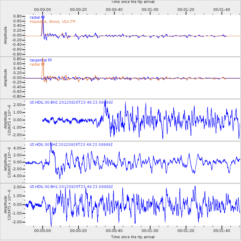
Earthquake location: Andreanof Islands, Aleutian Is.
Earthquake latitude/longitude: 51.6/-178.3
Earthquake time(UTC): 2012/09/26 (270) 23:39:55 GMT
Earthquake Depth: 16 km
Earthquake Magnitude: 6.3 MB, 6.5 MS, 6.4 MW, 6.4 MW
Earthquake Catalog/Contributor: WHDF/NEIC
Network: US United States National Seismic Network
Station: HDIL Hopedale, Illinois, USA
Lat/Lon: 40.56 N/89.29 W
Elevation: 219 m
Distance: 59.0 deg
Az: 62.673 deg
Baz: 313.333 deg
Ray Param: 0.062439844
Estimated Moho Depth: 41.5 km
Estimated Crust Vp/Vs: 2.02
Assumed Crust Vp: 6.498 km/s
Estimated Crust Vs: 3.213 km/s
Estimated Crust Poisson's Ratio: 0.34
Radial Match: 91.89883 %
Radial Bump: 400
Transverse Match: 71.52298 %
Transverse Bump: 400
SOD ConfigId: 558545
Insert Time: 2013-09-17 19:25:38.231 +0000
GWidth: 2.5
Max Bumps: 400
Tol: 0.001

Signal To Noise

ChannelStoNSTALTA
US:HDIL:00:BHZ:20120926T23:49:23.09999Z12.0073241.9703334E-61.6409429E-7
US:HDIL:00:BH1:20120926T23:49:23.09999Z3.42773567.5396446E-72.1995992E-7
US:HDIL:00:BH2:20120926T23:49:23.09999Z4.0402827.605955E-71.8825308E-7
Arrivals
Ps6.8 SECOND
PpPs18 SECOND
PsPs/PpSs25 SECOND