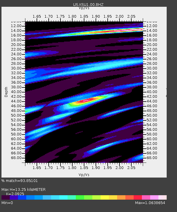
KSU1 Kansas State University--Konza Prairie, Kansas, USA - Earthquake Result Viewer
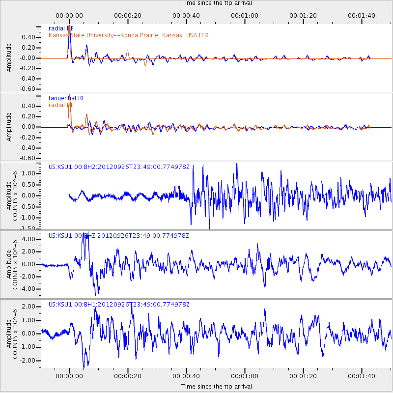
Earthquake location: Andreanof Islands, Aleutian Is.
Earthquake latitude/longitude: 51.6/-178.3
Earthquake time(UTC): 2012/09/26 (270) 23:39:55 GMT
Earthquake Depth: 16 km
Earthquake Magnitude: 6.3 MB, 6.5 MS, 6.4 MW, 6.4 MW
Earthquake Catalog/Contributor: WHDF/NEIC
Network: US United States National Seismic Network
Station: KSU1 Kansas State University--Konza Prairie, Kansas, USA
Lat/Lon: 39.10 N/96.61 W
Elevation: 347 m
Distance: 55.9 deg
Az: 68.46 deg
Baz: 311.779 deg
Ray Param: 0.06449986
Estimated Moho Depth: 13.25 km
Estimated Crust Vp/Vs: 2.09
Assumed Crust Vp: 6.483 km/s
Estimated Crust Vs: 3.098 km/s
Estimated Crust Poisson's Ratio: 0.35
Radial Match: 93.85101 %
Radial Bump: 400
Transverse Match: 80.77023 %
Transverse Bump: 400
SOD ConfigId: 558545
Insert Time: 2013-09-17 19:26:08.197 +0000
GWidth: 2.5
Max Bumps: 400
Tol: 0.001

Signal To Noise

ChannelStoNSTALTA
US:KSU1:00:BHZ:20120926T23:49:00.774978Z18.472111.779314E-69.632434E-8
US:KSU1:00:BH1:20120926T23:49:00.774978Z4.29448187.0049106E-71.6311424E-7
US:KSU1:00:BH2:20120926T23:49:00.774978Z0.94117899.742676E-81.0351567E-7
Arrivals
Ps2.3 SECOND
PpPs6.0 SECOND
PsPs/PpSs8.4 SECOND