MIAR Mount Ida, Arkansas, USA - Earthquake Result Viewer
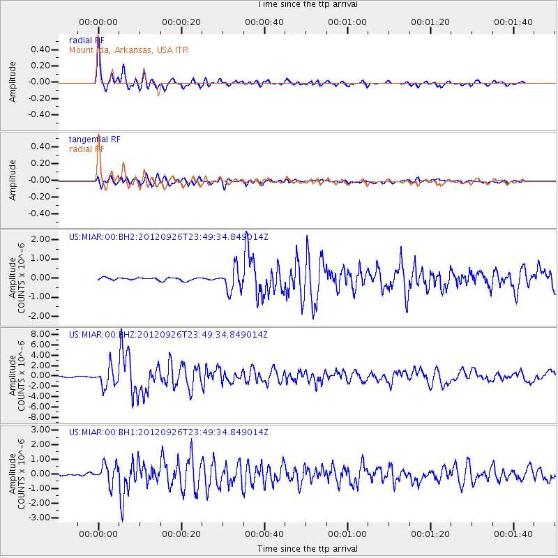
Earthquake location: Andreanof Islands, Aleutian Is.
Earthquake latitude/longitude: 51.6/-178.3
Earthquake time(UTC): 2012/09/26 (270) 23:39:55 GMT
Earthquake Depth: 16 km
Earthquake Magnitude: 6.3 MB, 6.5 MS, 6.4 MW, 6.4 MW
Earthquake Catalog/Contributor: WHDF/NEIC
Network: US United States National Seismic Network
Station: MIAR Mount Ida, Arkansas, USA
Lat/Lon: 34.55 N/93.58 W
Elevation: 207 m
Distance: 60.8 deg
Az: 70.396 deg
Baz: 314.608 deg
Ray Param: 0.061310537
Estimated Moho Depth: 27.75 km
Estimated Crust Vp/Vs: 1.73
Assumed Crust Vp: 6.498 km/s
Estimated Crust Vs: 3.761 km/s
Estimated Crust Poisson's Ratio: 0.25
Radial Match: 95.08147 %
Radial Bump: 325
Transverse Match: 93.03801 %
Transverse Bump: 400
SOD ConfigId: 558545
Insert Time: 2013-09-17 19:26:40.953 +0000
GWidth: 2.5
Max Bumps: 400
Tol: 0.001

Signal To Noise

ChannelStoNSTALTA
US:MIAR:00:BHZ:20120926T23:49:34.849014Z15.6318581.8947924E-61.212135E-7
US:MIAR:00:BH1:20120926T23:49:34.849014Z10.9585226.785443E-76.191933E-8
US:MIAR:00:BH2:20120926T23:49:34.849014Z8.6117766.128489E-77.116405E-8
Arrivals
Ps3.3 SECOND
PpPs11 SECOND
PsPs/PpSs14 SECOND