WMOK Wichita Mountains, Oklahoma, USA - Earthquake Result Viewer
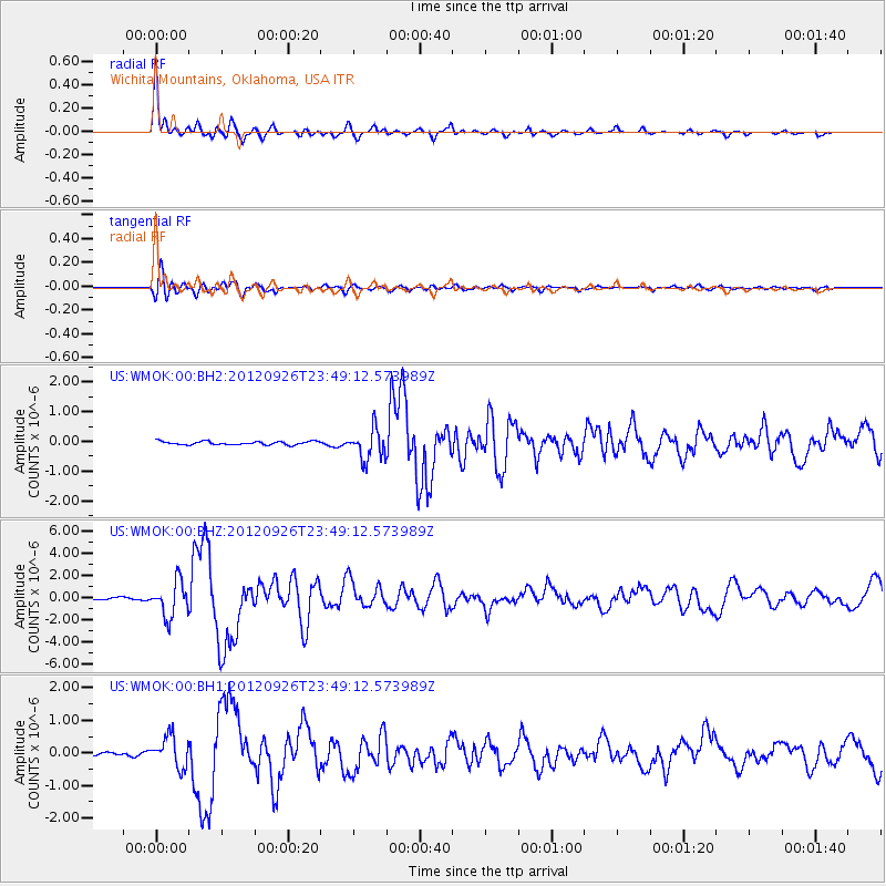
Earthquake location: Andreanof Islands, Aleutian Is.
Earthquake latitude/longitude: 51.6/-178.3
Earthquake time(UTC): 2012/09/26 (270) 23:39:55 GMT
Earthquake Depth: 16 km
Earthquake Magnitude: 6.3 MB, 6.5 MS, 6.4 MW, 6.4 MW
Earthquake Catalog/Contributor: WHDF/NEIC
Network: US United States National Seismic Network
Station: WMOK Wichita Mountains, Oklahoma, USA
Lat/Lon: 34.74 N/98.78 W
Elevation: 486 m
Distance: 57.5 deg
Az: 73.706 deg
Baz: 313.361 deg
Ray Param: 0.06341751
Estimated Moho Depth: 62.0 km
Estimated Crust Vp/Vs: 1.61
Assumed Crust Vp: 6.315 km/s
Estimated Crust Vs: 3.916 km/s
Estimated Crust Poisson's Ratio: 0.19
Radial Match: 96.59203 %
Radial Bump: 297
Transverse Match: 90.76399 %
Transverse Bump: 400
SOD ConfigId: 558545
Insert Time: 2013-09-17 19:27:49.649 +0000
GWidth: 2.5
Max Bumps: 400
Tol: 0.001

Signal To Noise

ChannelStoNSTALTA
US:WMOK:00:BHZ:20120926T23:49:12.573989Z12.097711.567321E-61.2955519E-7
US:WMOK:00:BH1:20120926T23:49:12.573989Z7.6330634.656564E-76.100518E-8
US:WMOK:00:BH2:20120926T23:49:12.573989Z8.9759755.0208445E-75.5936482E-8
Arrivals
Ps6.3 SECOND
PpPs24 SECOND
PsPs/PpSs31 SECOND