You are here: Home > Network List > US - United States National Seismic Network Stations List
> Station LAO LASA Array, Montana, USA > Earthquake Result Viewer
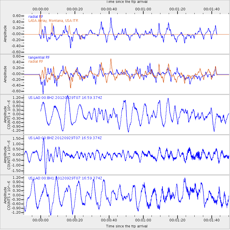
LAO LASA Array, Montana, USA - Earthquake Result Viewer
*The percent match for this event was below the threshold and hence no stack was calculated.
| Earthquake location: |
Near Coast Of Guerrero, Mexico |
| Earthquake latitude/longitude: |
16.3/-98.4 |
| Earthquake time(UTC): |
2012/09/29 (273) 07:11:12 GMT |
| Earthquake Depth: |
12 km |
| Earthquake Magnitude: |
5.5 MW, 4.9 MS, 5.3 MB, 5.4 MW |
| Earthquake Catalog/Contributor: |
WHDF/NEIC |
|
| Network: |
US United States National Seismic Network |
| Station: |
LAO LASA Array, Montana, USA |
| Lat/Lon: |
46.69 N/106.22 W |
| Elevation: |
902 m |
|
| Distance: |
31.0 deg |
| Az: |
349.505 deg |
| Baz: |
165.28 deg |
| Ray Param: |
$rayparam |
*The percent match for this event was below the threshold and hence was not used in the summary stack. |
|
| Radial Match: |
46.685425 % |
| Radial Bump: |
380 |
| Transverse Match: |
63.54579 % |
| Transverse Bump: |
400 |
| SOD ConfigId: |
558545 |
| Insert Time: |
2013-09-17 19:33:37.630 +0000 |
| GWidth: |
2.5 |
| Max Bumps: |
400 |
| Tol: |
0.001 |
|
Signal To Noise
| Channel | StoN | STA | LTA |
| US:LAO:00:BHZ:20120929T07:16:59.374Z | 3.17291 | 8.511436E-7 | 2.682533E-7 |
| US:LAO:00:BH1:20120929T07:16:59.374Z | 0.7921223 | 3.9056997E-7 | 4.930678E-7 |
| US:LAO:00:BH2:20120929T07:16:59.374Z | 0.4868719 | 3.1351846E-7 | 6.439444E-7 |
| Arrivals |
| Ps | |
| PpPs | |
| PsPs/PpSs | |


