You are here: Home > Network List > US - United States National Seismic Network Stations List
> Station HDIL Hopedale, Illinois, USA > Earthquake Result Viewer
HDIL Hopedale, Illinois, USA - Earthquake Result Viewer

| Earthquake location: |
Colombia |
| Earthquake latitude/longitude: |
1.9/-76.4 |
| Earthquake time(UTC): |
2012/09/30 (274) 16:31:35 GMT |
| Earthquake Depth: |
170 km |
| Earthquake Magnitude: |
7.0 MB, 7.3 MW, 7.2 MW |
| Earthquake Catalog/Contributor: |
WHDF/NEIC |
|
| Network: |
US United States National Seismic Network |
| Station: |
HDIL Hopedale, Illinois, USA |
| Lat/Lon: |
40.56 N/89.29 W |
| Elevation: |
219 m |
|
| Distance: |
40.2 deg |
| Az: |
344.681 deg |
| Baz: |
159.723 deg |
| Ray Param: |
0.07390706 |
| Estimated Moho Depth: |
17.75 km |
| Estimated Crust Vp/Vs: |
2.05 |
| Assumed Crust Vp: |
6.498 km/s |
| Estimated Crust Vs: |
3.166 km/s |
| Estimated Crust Poisson's Ratio: |
0.34 |
|
| Radial Match: |
92.483154 % |
| Radial Bump: |
400 |
| Transverse Match: |
68.15865 % |
| Transverse Bump: |
400 |
| SOD ConfigId: |
558545 |
| Insert Time: |
2013-09-17 19:37:43.355 +0000 |
| GWidth: |
2.5 |
| Max Bumps: |
400 |
| Tol: |
0.001 |
|
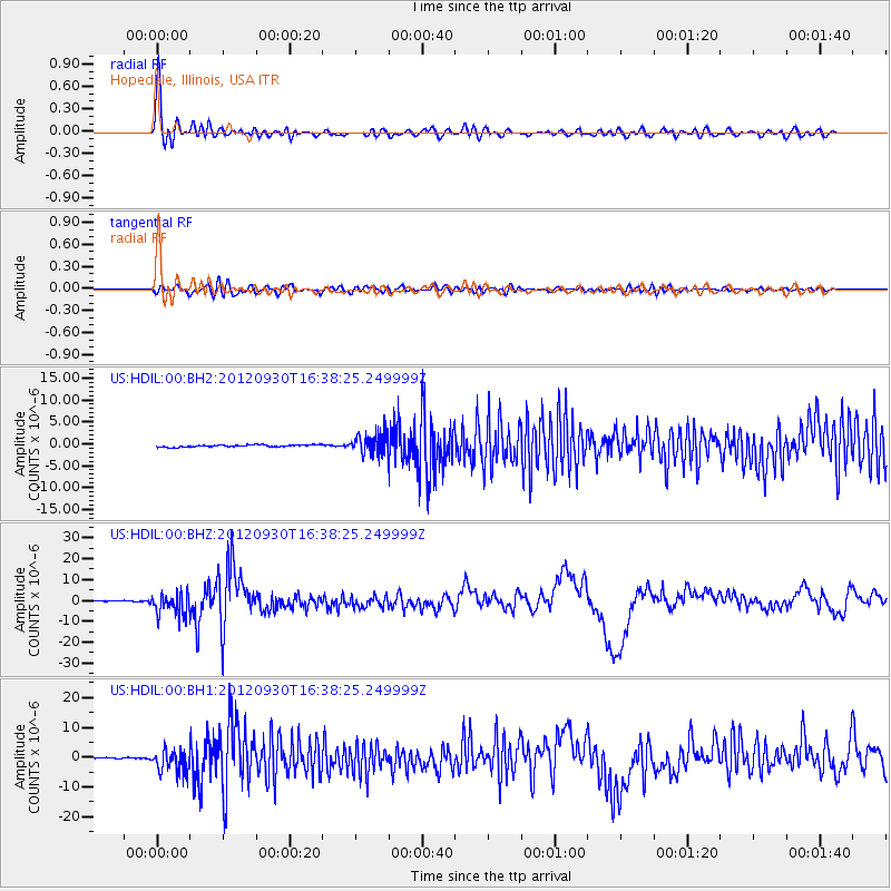
Signal To Noise
| Channel | StoN | STA | LTA |
| US:HDIL:00:BHZ:20120930T16:38:25.249999Z | 36.708973 | 5.499713E-6 | 1.4981933E-7 |
| US:HDIL:00:BH1:20120930T16:38:25.249999Z | 23.374657 | 3.8591293E-6 | 1.6509887E-7 |
| US:HDIL:00:BH2:20120930T16:38:25.249999Z | 10.116337 | 2.4251271E-6 | 2.3972387E-7 |
| Arrivals |
| Ps | 3.1 SECOND |
| PpPs | 7.8 SECOND |
| PsPs/PpSs | 11 SECOND |


