KAPI Kappang, Sulawesi, Indonesia - Earthquake Result Viewer
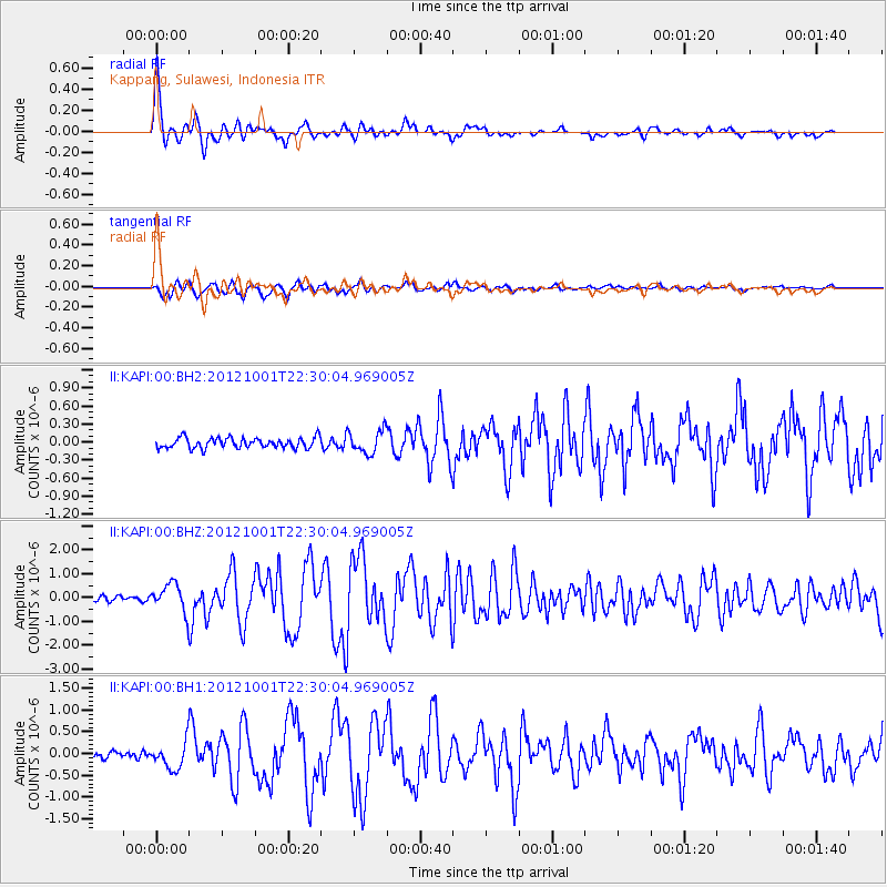
Earthquake location: Off East Coast Of Honshu, Japan
Earthquake latitude/longitude: 39.8/143.1
Earthquake time(UTC): 2012/10/01 (275) 22:21:46 GMT
Earthquake Depth: 15 km
Earthquake Magnitude: 5.6 MB, 5.7 MS, 6.1 MW, 6.0 MW
Earthquake Catalog/Contributor: WHDF/NEIC
Network: II Global Seismograph Network (GSN - IRIS/IDA)
Station: KAPI Kappang, Sulawesi, Indonesia
Lat/Lon: 5.01 S/119.75 E
Elevation: 300 m
Distance: 49.5 deg
Az: 211.269 deg
Baz: 23.662 deg
Ray Param: 0.068636425
Estimated Moho Depth: 37.75 km
Estimated Crust Vp/Vs: 1.71
Assumed Crust Vp: 6.343 km/s
Estimated Crust Vs: 3.715 km/s
Estimated Crust Poisson's Ratio: 0.24
Radial Match: 93.46968 %
Radial Bump: 400
Transverse Match: 90.35385 %
Transverse Bump: 400
SOD ConfigId: 558545
Insert Time: 2013-09-17 19:43:17.579 +0000
GWidth: 2.5
Max Bumps: 400
Tol: 0.001

Signal To Noise

ChannelStoNSTALTA
II:KAPI:00:BHZ:20121001T22:30:04.969005Z5.7896675.754938E-79.9400154E-8
II:KAPI:00:BH1:20121001T22:30:04.969005Z4.08059023.0355918E-77.4391E-8
II:KAPI:00:BH2:20121001T22:30:04.969005Z2.22519371.9190453E-78.624172E-8
Arrivals
Ps4.5 SECOND
PpPs15 SECOND
PsPs/PpSs20 SECOND