GNI Garni, Armenia - Earthquake Result Viewer
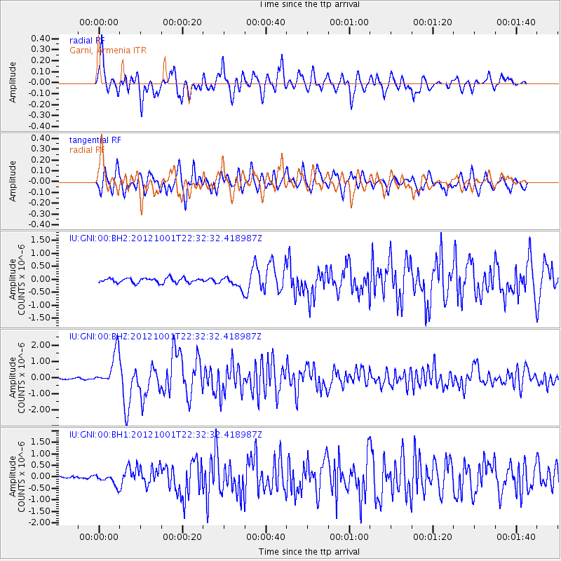
Earthquake location: Off East Coast Of Honshu, Japan
Earthquake latitude/longitude: 39.8/143.1
Earthquake time(UTC): 2012/10/01 (275) 22:21:46 GMT
Earthquake Depth: 15 km
Earthquake Magnitude: 5.6 MB, 5.7 MS, 6.1 MW, 6.0 MW
Earthquake Catalog/Contributor: WHDF/NEIC
Network: IU Global Seismograph Network (GSN - IRIS/USGS)
Station: GNI Garni, Armenia
Lat/Lon: 40.15 N/44.74 E
Elevation: 1609 m
Distance: 71.1 deg
Az: 306.724 deg
Baz: 53.658 deg
Ray Param: 0.054525748
Estimated Moho Depth: 69.0 km
Estimated Crust Vp/Vs: 1.82
Assumed Crust Vp: 6.291 km/s
Estimated Crust Vs: 3.452 km/s
Estimated Crust Poisson's Ratio: 0.28
Radial Match: 85.82046 %
Radial Bump: 400
Transverse Match: 86.03462 %
Transverse Bump: 400
SOD ConfigId: 558545
Insert Time: 2013-09-17 19:44:16.411 +0000
GWidth: 2.5
Max Bumps: 400
Tol: 0.001

Signal To Noise

ChannelStoNSTALTA
IU:GNI:00:BHZ:20121001T22:32:32.418987Z17.7572781.1173776E-66.292505E-8
IU:GNI:00:BH1:20121001T22:32:32.418987Z4.5215562.5492128E-75.6379104E-8
IU:GNI:00:BH2:20121001T22:32:32.418987Z2.59492522.3333072E-78.9918096E-8
Arrivals
Ps9.3 SECOND
PpPs30 SECOND
PsPs/PpSs39 SECOND