You are here: Home > Network List > US - United States National Seismic Network Stations List
> Station EGMT Eagleton, Montana, USA > Earthquake Result Viewer
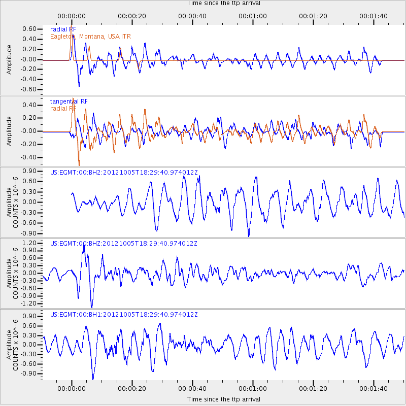
EGMT Eagleton, Montana, USA - Earthquake Result Viewer
*The percent match for this event was below the threshold and hence no stack was calculated.
| Earthquake location: |
Near Coast Of Guatemala |
| Earthquake latitude/longitude: |
13.0/-91.5 |
| Earthquake time(UTC): |
2012/10/05 (279) 18:22:56 GMT |
| Earthquake Depth: |
41 km |
| Earthquake Magnitude: |
5.5 MW, 5.5 MW |
| Earthquake Catalog/Contributor: |
NEIC PDE/NEIC PDE-W |
|
| Network: |
US United States National Seismic Network |
| Station: |
EGMT Eagleton, Montana, USA |
| Lat/Lon: |
48.02 N/109.75 W |
| Elevation: |
1055 m |
|
| Distance: |
38.1 deg |
| Az: |
340.062 deg |
| Baz: |
150.325 deg |
| Ray Param: |
$rayparam |
*The percent match for this event was below the threshold and hence was not used in the summary stack. |
|
| Radial Match: |
72.19985 % |
| Radial Bump: |
400 |
| Transverse Match: |
64.82031 % |
| Transverse Bump: |
400 |
| SOD ConfigId: |
558545 |
| Insert Time: |
2013-09-17 20:02:20.961 +0000 |
| GWidth: |
2.5 |
| Max Bumps: |
400 |
| Tol: |
0.001 |
|
Signal To Noise
| Channel | StoN | STA | LTA |
| US:EGMT:00:BHZ:20121005T18:29:40.974012Z | 3.606588 | 5.3043465E-7 | 1.4707382E-7 |
| US:EGMT:00:BH1:20121005T18:29:40.974012Z | 1.1256897 | 2.489938E-7 | 2.2119222E-7 |
| US:EGMT:00:BH2:20121005T18:29:40.974012Z | 1.8568139 | 3.1241547E-7 | 1.6825352E-7 |
| Arrivals |
| Ps | |
| PpPs | |
| PsPs/PpSs | |


