You are here: Home > Network List > US - United States National Seismic Network Stations List
> Station LONY Lake Ozonia, New York, USA > Earthquake Result Viewer
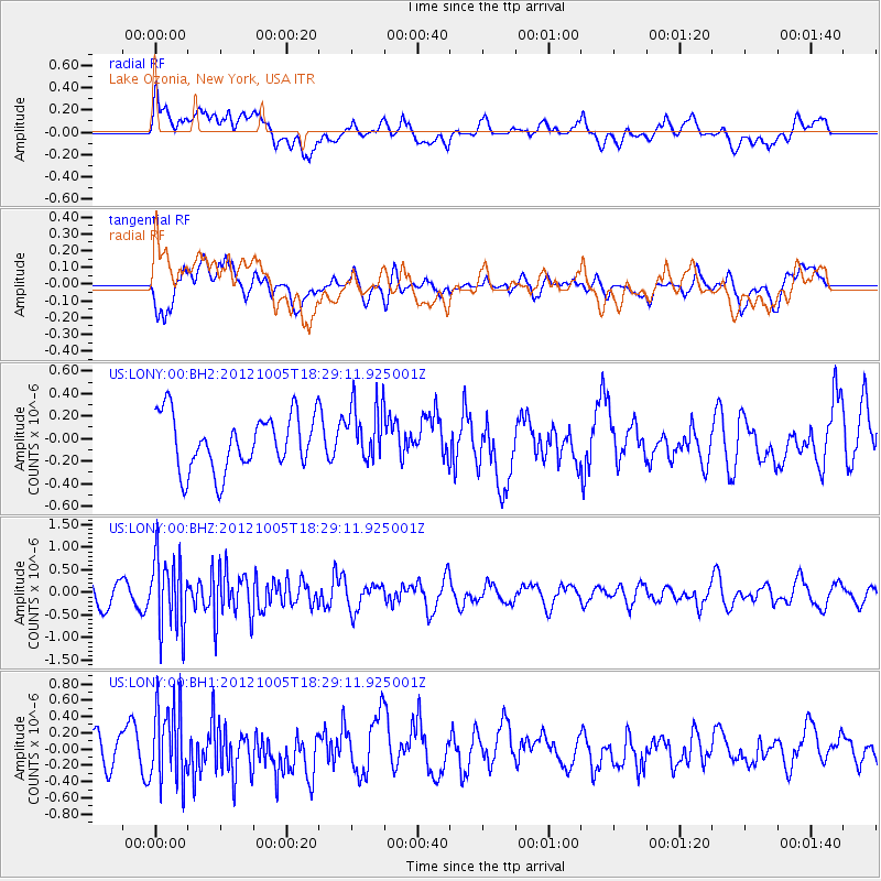
LONY Lake Ozonia, New York, USA - Earthquake Result Viewer
*The percent match for this event was below the threshold and hence no stack was calculated.
| Earthquake location: |
Near Coast Of Guatemala |
| Earthquake latitude/longitude: |
13.0/-91.5 |
| Earthquake time(UTC): |
2012/10/05 (279) 18:22:56 GMT |
| Earthquake Depth: |
41 km |
| Earthquake Magnitude: |
5.5 MW, 5.5 MW |
| Earthquake Catalog/Contributor: |
NEIC PDE/NEIC PDE-W |
|
| Network: |
US United States National Seismic Network |
| Station: |
LONY Lake Ozonia, New York, USA |
| Lat/Lon: |
44.62 N/74.58 W |
| Elevation: |
440 m |
|
| Distance: |
34.6 deg |
| Az: |
21.444 deg |
| Baz: |
209.929 deg |
| Ray Param: |
$rayparam |
*The percent match for this event was below the threshold and hence was not used in the summary stack. |
|
| Radial Match: |
50.70641 % |
| Radial Bump: |
400 |
| Transverse Match: |
49.65285 % |
| Transverse Bump: |
400 |
| SOD ConfigId: |
558545 |
| Insert Time: |
2013-09-17 20:02:41.341 +0000 |
| GWidth: |
2.5 |
| Max Bumps: |
400 |
| Tol: |
0.001 |
|
Signal To Noise
| Channel | StoN | STA | LTA |
| US:LONY:00:BHZ:20121005T18:29:11.925001Z | 3.553829 | 8.055333E-7 | 2.2666632E-7 |
| US:LONY:00:BH1:20121005T18:29:11.925001Z | 1.9994379 | 4.7176212E-7 | 2.3594737E-7 |
| US:LONY:00:BH2:20121005T18:29:11.925001Z | 1.0698812 | 2.6099497E-7 | 2.439476E-7 |
| Arrivals |
| Ps | |
| PpPs | |
| PsPs/PpSs | |


