You are here: Home > Network List > US - United States National Seismic Network Stations List
> Station WRAK Wrangell Island, Southeastern Alaska, Alaska, USA > Earthquake Result Viewer
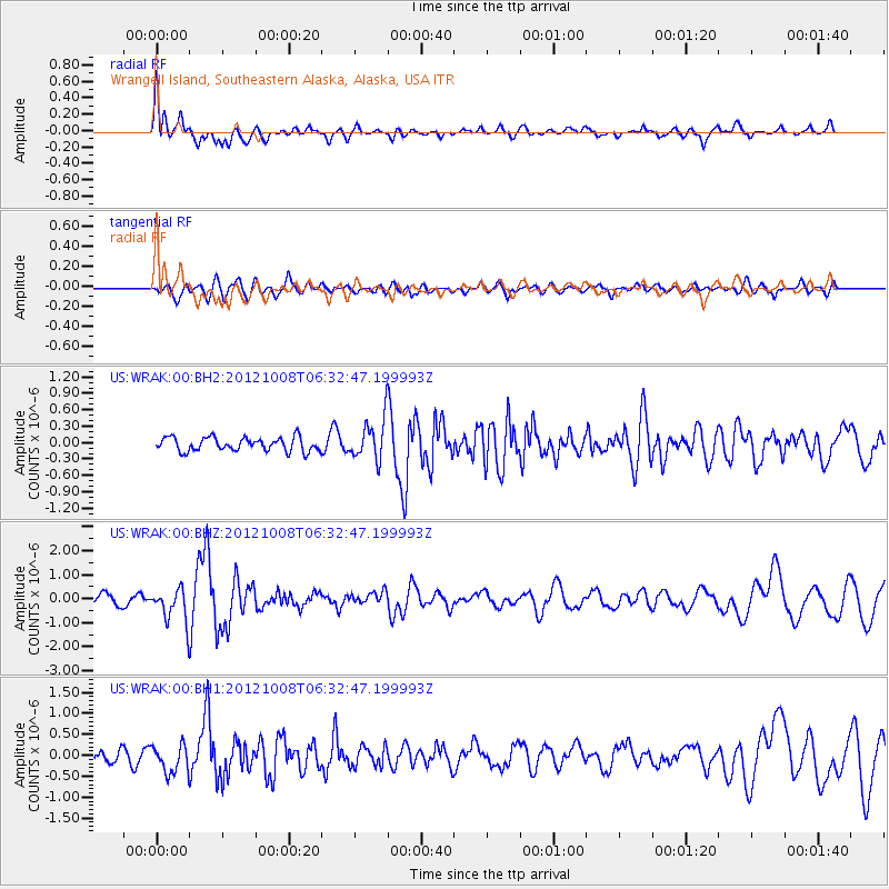
WRAK Wrangell Island, Southeastern Alaska, Alaska, USA - Earthquake Result Viewer
*The percent match for this event was below the threshold and hence no stack was calculated.
| Earthquake location: |
Gulf Of California |
| Earthquake latitude/longitude: |
25.1/-109.6 |
| Earthquake time(UTC): |
2012/10/08 (282) 06:26:23 GMT |
| Earthquake Depth: |
14 km |
| Earthquake Magnitude: |
6.0 MW, 5.6 MB, 5.7 MS, 5.9 MW |
| Earthquake Catalog/Contributor: |
NEIC PDE/NEIC PDE-W |
|
| Network: |
US United States National Seismic Network |
| Station: |
WRAK Wrangell Island, Southeastern Alaska, Alaska, USA |
| Lat/Lon: |
56.42 N/132.35 W |
| Elevation: |
81 m |
|
| Distance: |
35.4 deg |
| Az: |
338.181 deg |
| Baz: |
142.678 deg |
| Ray Param: |
$rayparam |
*The percent match for this event was below the threshold and hence was not used in the summary stack. |
|
| Radial Match: |
77.241905 % |
| Radial Bump: |
400 |
| Transverse Match: |
68.53755 % |
| Transverse Bump: |
400 |
| SOD ConfigId: |
558545 |
| Insert Time: |
2013-09-17 20:16:38.396 +0000 |
| GWidth: |
2.5 |
| Max Bumps: |
400 |
| Tol: |
0.001 |
|
Signal To Noise
| Channel | StoN | STA | LTA |
| US:WRAK:00:BHZ:20121008T06:32:47.199993Z | 3.0712268 | 7.016201E-7 | 2.2844947E-7 |
| US:WRAK:00:BH1:20121008T06:32:47.199993Z | 1.8356552 | 3.3045941E-7 | 1.800226E-7 |
| US:WRAK:00:BH2:20121008T06:32:47.199993Z | 2.929511 | 3.6392203E-7 | 1.242262E-7 |
| Arrivals |
| Ps | |
| PpPs | |
| PsPs/PpSs | |


