You are here: Home > Network List > IU - Global Seismograph Network (GSN - IRIS/USGS) Stations List
> Station HNR Honiara, Solomon Islands > Earthquake Result Viewer
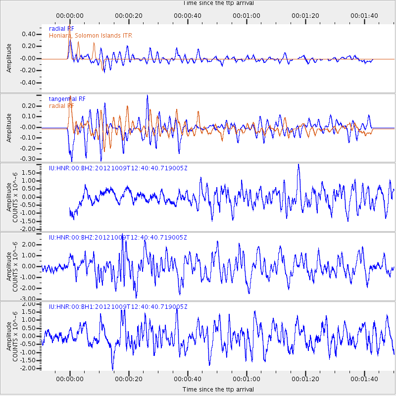
HNR Honiara, Solomon Islands - Earthquake Result Viewer
*The percent match for this event was below the threshold and hence no stack was calculated.
| Earthquake location: |
West Of Macquarie Island |
| Earthquake latitude/longitude: |
-60.3/153.7 |
| Earthquake time(UTC): |
2012/10/09 (283) 12:32:09 GMT |
| Earthquake Depth: |
10 km |
| Earthquake Magnitude: |
5.6 MB, 6.2 MS, 6.6 MW, 6.3 MW |
| Earthquake Catalog/Contributor: |
WHDF/NEIC |
|
| Network: |
IU Global Seismograph Network (GSN - IRIS/USGS) |
| Station: |
HNR Honiara, Solomon Islands |
| Lat/Lon: |
9.44 S/159.95 E |
| Elevation: |
100 m |
|
| Distance: |
51.0 deg |
| Az: |
7.943 deg |
| Baz: |
183.996 deg |
| Ray Param: |
$rayparam |
*The percent match for this event was below the threshold and hence was not used in the summary stack. |
|
| Radial Match: |
63.05646 % |
| Radial Bump: |
400 |
| Transverse Match: |
60.03893 % |
| Transverse Bump: |
400 |
| SOD ConfigId: |
558545 |
| Insert Time: |
2013-09-17 20:21:32.632 +0000 |
| GWidth: |
2.5 |
| Max Bumps: |
400 |
| Tol: |
0.001 |
|
Signal To Noise
| Channel | StoN | STA | LTA |
| IU:HNR:00:BHZ:20121009T12:40:40.719005Z | 2.4114475 | 6.630379E-7 | 2.749543E-7 |
| IU:HNR:00:BH1:20121009T12:40:40.719005Z | 1.0710824 | 5.1040837E-7 | 4.7653515E-7 |
| IU:HNR:00:BH2:20121009T12:40:40.719005Z | 0.53442514 | 2.4685224E-7 | 4.6190235E-7 |
| Arrivals |
| Ps | |
| PpPs | |
| PsPs/PpSs | |


