
NWAO Narrogin, Australia - Earthquake Result Viewer
| ||||||||||||||||||
| ||||||||||||||||||
| ||||||||||||||||||
|
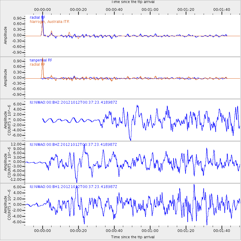
Signal To Noise
| Channel | StoN | STA | LTA |
| IU:NWAO:00:BHZ:20121012T00:37:23.418987Z | 3.1346612 | 1.8374167E-6 | 5.8616115E-7 |
| IU:NWAO:00:BH1:20121012T00:37:23.418987Z | 3.5047154 | 8.5176003E-7 | 2.430326E-7 |
| IU:NWAO:00:BH2:20121012T00:37:23.418987Z | 2.0933938 | 1.0333936E-6 | 4.9364513E-7 |
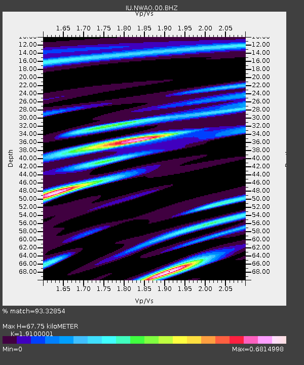
| Arrivals | |
| Ps | 10 SECOND |
| PpPs | 29 SECOND |
| PsPs/PpSs | 39 SECOND |

