
SNZO South Karori, New Zealand - Earthquake Result Viewer
| ||||||||||||||||||
| ||||||||||||||||||
| ||||||||||||||||||
|
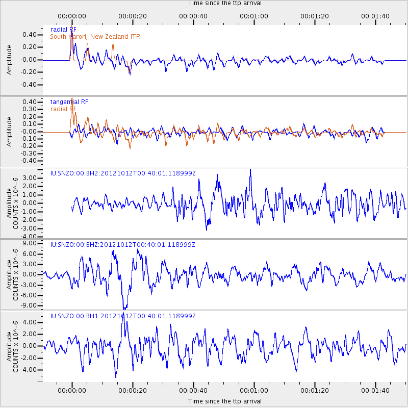
Signal To Noise
| Channel | StoN | STA | LTA |
| IU:SNZO:00:BHZ:20121012T00:40:01.118999Z | 4.88053 | 2.8779093E-6 | 5.896715E-7 |
| IU:SNZO:00:BH1:20121012T00:40:01.118999Z | 2.7492685 | 1.7235026E-6 | 6.268949E-7 |
| IU:SNZO:00:BH2:20121012T00:40:01.118999Z | 1.7320603 | 8.198681E-7 | 4.7334848E-7 |
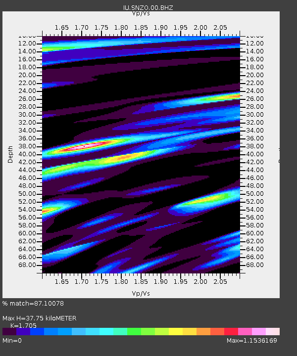
| Arrivals | |
| Ps | 4.4 SECOND |
| PpPs | 15 SECOND |
| PsPs/PpSs | 19 SECOND |

