You are here: Home > Network List > IU - Global Seismograph Network (GSN - IRIS/USGS) Stations List
> Station JOHN Johnston Island, USA > Earthquake Result Viewer
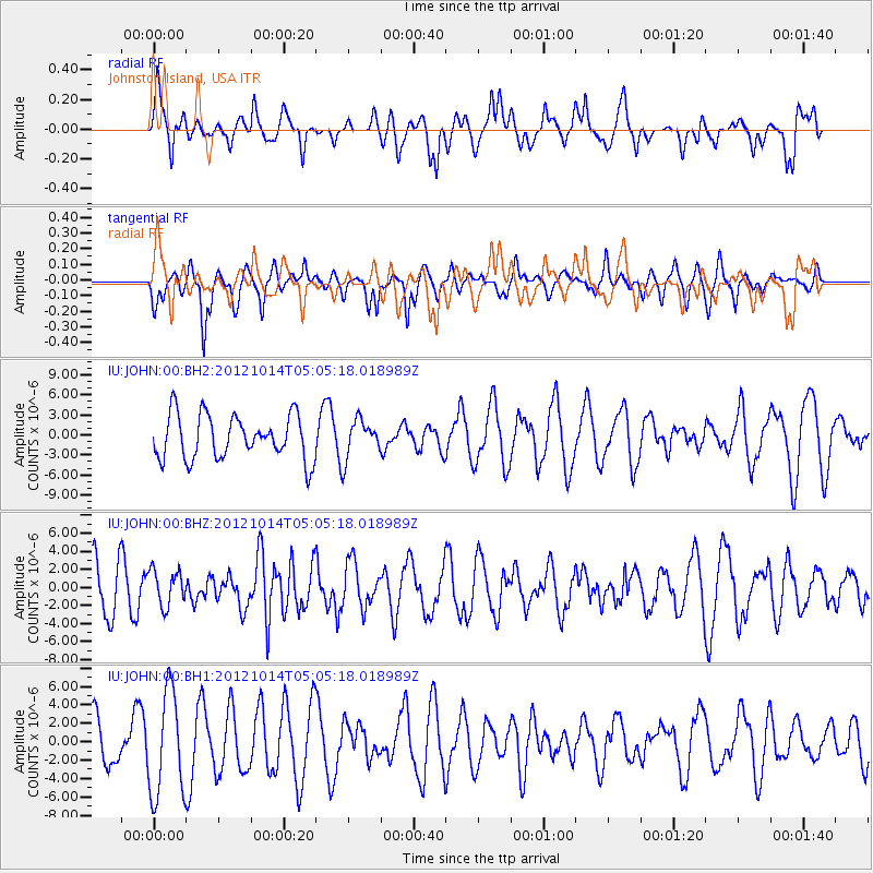
JOHN Johnston Island, USA - Earthquake Result Viewer
*The percent match for this event was below the threshold and hence no stack was calculated.
| Earthquake location: |
Solomon Islands |
| Earthquake latitude/longitude: |
-7.1/156.0 |
| Earthquake time(UTC): |
2012/10/14 (288) 04:58:04 GMT |
| Earthquake Depth: |
37 km |
| Earthquake Magnitude: |
5.8 MB, 5.5 MS, 5.8 MW, 5.8 MW |
| Earthquake Catalog/Contributor: |
WHDF/NEIC |
|
| Network: |
IU Global Seismograph Network (GSN - IRIS/USGS) |
| Station: |
JOHN Johnston Island, USA |
| Lat/Lon: |
16.73 N/169.53 W |
| Elevation: |
2.0 m |
|
| Distance: |
41.5 deg |
| Az: |
54.834 deg |
| Baz: |
237.847 deg |
| Ray Param: |
$rayparam |
*The percent match for this event was below the threshold and hence was not used in the summary stack. |
|
| Radial Match: |
50.943222 % |
| Radial Bump: |
400 |
| Transverse Match: |
64.27466 % |
| Transverse Bump: |
387 |
| SOD ConfigId: |
558545 |
| Insert Time: |
2013-09-17 20:29:23.553 +0000 |
| GWidth: |
2.5 |
| Max Bumps: |
400 |
| Tol: |
0.001 |
|
Signal To Noise
| Channel | StoN | STA | LTA |
| IU:JOHN:00:BHZ:20121014T05:05:18.018989Z | 0.7233189 | 1.9843212E-6 | 2.743356E-6 |
| IU:JOHN:00:BH1:20121014T05:05:18.018989Z | 1.7704505 | 5.6830113E-6 | 3.209924E-6 |
| IU:JOHN:00:BH2:20121014T05:05:18.018989Z | 0.8595123 | 2.8416275E-6 | 3.3060928E-6 |
| Arrivals |
| Ps | |
| PpPs | |
| PsPs/PpSs | |


