You are here: Home > Network List > US - United States National Seismic Network Stations List
> Station BRAL Brewton, Alabama, USA > Earthquake Result Viewer
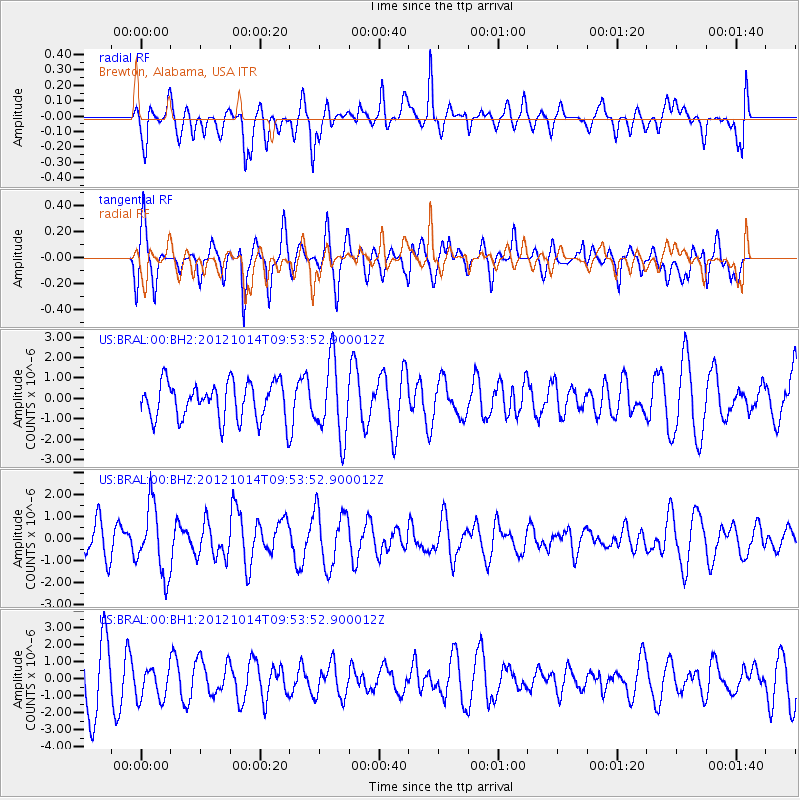
BRAL Brewton, Alabama, USA - Earthquake Result Viewer
*The percent match for this event was below the threshold and hence no stack was calculated.
| Earthquake location: |
Kuril Islands |
| Earthquake latitude/longitude: |
48.3/154.4 |
| Earthquake time(UTC): |
2012/10/14 (288) 09:41:58 GMT |
| Earthquake Depth: |
35 km |
| Earthquake Magnitude: |
5.7 MB, 5.2 MS, 5.7 MW, 5.7 MW |
| Earthquake Catalog/Contributor: |
WHDF/NEIC |
|
| Network: |
US United States National Seismic Network |
| Station: |
BRAL Brewton, Alabama, USA |
| Lat/Lon: |
31.01 N/87.06 W |
| Elevation: |
61 m |
|
| Distance: |
83.8 deg |
| Az: |
49.365 deg |
| Baz: |
323.837 deg |
| Ray Param: |
$rayparam |
*The percent match for this event was below the threshold and hence was not used in the summary stack. |
|
| Radial Match: |
43.921326 % |
| Radial Bump: |
360 |
| Transverse Match: |
59.699955 % |
| Transverse Bump: |
343 |
| SOD ConfigId: |
558545 |
| Insert Time: |
2013-09-17 20:33:17.777 +0000 |
| GWidth: |
2.5 |
| Max Bumps: |
400 |
| Tol: |
0.001 |
|
Signal To Noise
| Channel | StoN | STA | LTA |
| US:BRAL:00:BHZ:20121014T09:53:52.900012Z | 2.2221036 | 1.5696183E-6 | 7.0636594E-7 |
| US:BRAL:00:BH1:20121014T09:53:52.900012Z | 0.7098522 | 9.863411E-7 | 1.389502E-6 |
| US:BRAL:00:BH2:20121014T09:53:52.900012Z | 1.9856763 | 1.8917339E-6 | 9.5268996E-7 |
| Arrivals |
| Ps | |
| PpPs | |
| PsPs/PpSs | |


