You are here: Home > Network List > US - United States National Seismic Network Stations List
> Station MIAR Mount Ida, Arkansas, USA > Earthquake Result Viewer
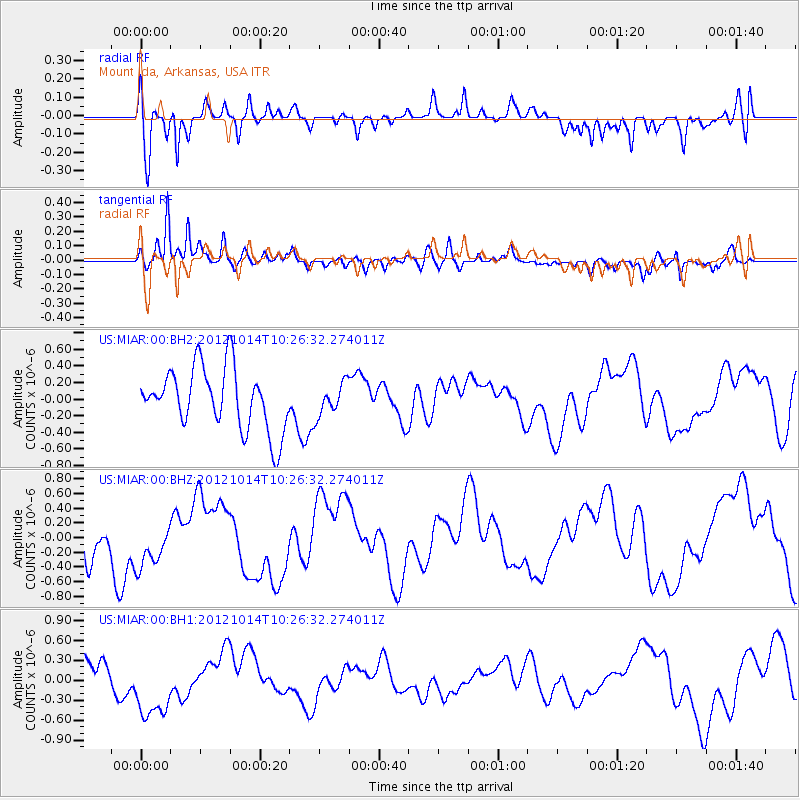
MIAR Mount Ida, Arkansas, USA - Earthquake Result Viewer
*The percent match for this event was below the threshold and hence no stack was calculated.
| Earthquake location: |
Eastern Caucasus |
| Earthquake latitude/longitude: |
41.8/46.4 |
| Earthquake time(UTC): |
2012/10/14 (288) 10:13:38 GMT |
| Earthquake Depth: |
10 km |
| Earthquake Magnitude: |
5.5 MW, 5.4 MS, 5.3 MB, 5.6 ML |
| Earthquake Catalog/Contributor: |
WHDF/NEIC |
|
| Network: |
US United States National Seismic Network |
| Station: |
MIAR Mount Ida, Arkansas, USA |
| Lat/Lon: |
34.55 N/93.58 W |
| Elevation: |
207 m |
|
| Distance: |
95.6 deg |
| Az: |
327.769 deg |
| Baz: |
28.875 deg |
| Ray Param: |
$rayparam |
*The percent match for this event was below the threshold and hence was not used in the summary stack. |
|
| Radial Match: |
66.467575 % |
| Radial Bump: |
400 |
| Transverse Match: |
81.93251 % |
| Transverse Bump: |
400 |
| SOD ConfigId: |
558545 |
| Insert Time: |
2013-09-17 20:37:53.768 +0000 |
| GWidth: |
2.5 |
| Max Bumps: |
400 |
| Tol: |
0.001 |
|
Signal To Noise
| Channel | StoN | STA | LTA |
| US:MIAR:00:BHZ:20121014T10:26:32.274011Z | 0.5767053 | 3.2132093E-7 | 5.5716663E-7 |
| US:MIAR:00:BH1:20121014T10:26:32.274011Z | 2.1773968 | 5.0544503E-7 | 2.321327E-7 |
| US:MIAR:00:BH2:20121014T10:26:32.274011Z | 0.5224791 | 1.9405253E-7 | 3.7140728E-7 |
| Arrivals |
| Ps | |
| PpPs | |
| PsPs/PpSs | |


