You are here: Home > Network List > US - United States National Seismic Network Stations List
> Station AMTX Amarillo, Texas, USA > Earthquake Result Viewer
AMTX Amarillo, Texas, USA - Earthquake Result Viewer
*The percent match for this event was below the threshold and hence no stack was calculated.
| Earthquake location: |
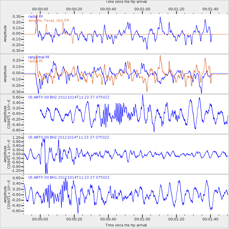
Off East Coast Of Honshu, Japan |
| Earthquake latitude/longitude: |
38.2/144.3 |
| Earthquake time(UTC): |
2012/10/14 (288) 11:11:36 GMT |
| Earthquake Depth: |
34 km |
| Earthquake Magnitude: |
5.6 MB, 4.9 MS, 5.4 MW |
| Earthquake Catalog/Contributor: |
WHDF/NEIC |
|
| Network: |
US United States National Seismic Network |
| Station: |
AMTX Amarillo, Texas, USA |
| Lat/Lon: |
34.53 N/101.41 W |
| Elevation: |
1010 m |
|
| Distance: |
85.4 deg |
| Az: |
49.038 deg |
| Baz: |
313.905 deg |
| Ray Param: |
$rayparam |
*The percent match for this event was below the threshold and hence was not used in the summary stack. |
|
| Radial Match: |
52.665363 % |
| Radial Bump: |
400 |
| Transverse Match: |
72.65299 % |
| Transverse Bump: |
400 |
| SOD ConfigId: |
558545 |
| Insert Time: |
2013-09-17 20:42:59.034 +0000 |
| GWidth: |
2.5 |
| Max Bumps: |
400 |
| Tol: |
0.001 |
|
Signal To Noise
| Channel | StoN | STA | LTA |
| US:AMTX:00:BHZ:20121014T11:23:37.07502Z | 3.9694135 | 8.209693E-7 | 2.0682384E-7 |
| US:AMTX:00:BH1:20121014T11:23:37.07502Z | 0.58600533 | 1.6772253E-7 | 2.862133E-7 |
| US:AMTX:00:BH2:20121014T11:23:37.07502Z | 1.532059 | 2.4717596E-7 | 1.6133579E-7 |
| Arrivals |
| Ps | |
| PpPs | |
| PsPs/PpSs | |


