You are here: Home > Network List > II - Global Seismograph Network (GSN - IRIS/IDA) Stations List
> Station KAPI Kappang, Sulawesi, Indonesia > Earthquake Result Viewer
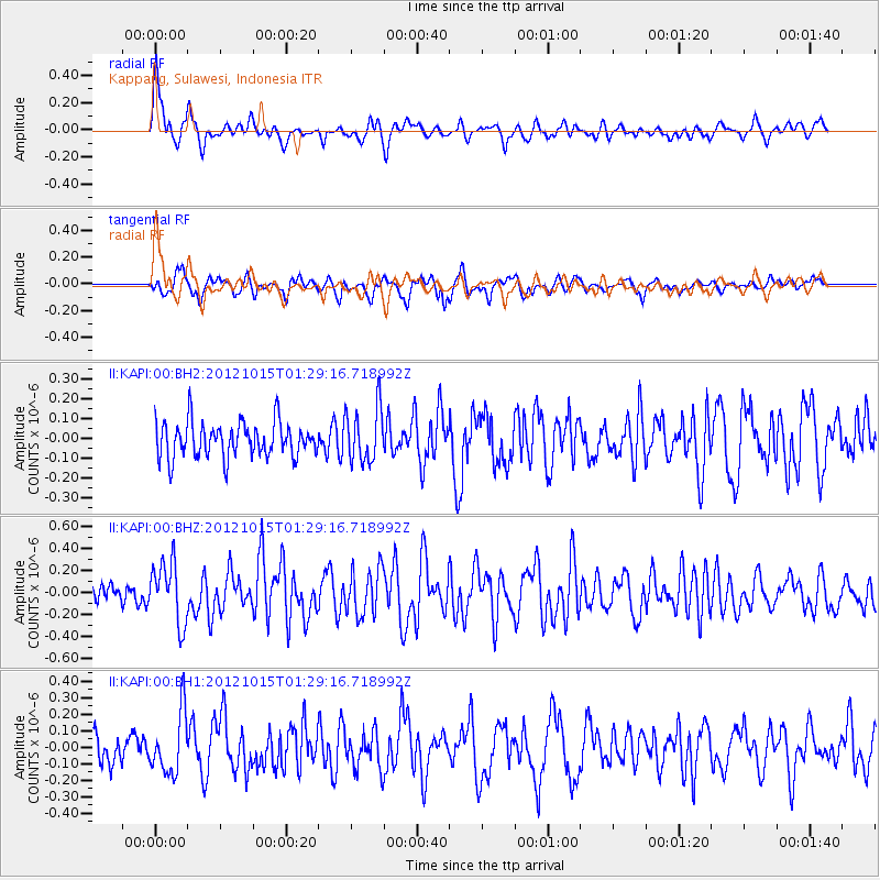
KAPI Kappang, Sulawesi, Indonesia - Earthquake Result Viewer
*The percent match for this event was below the threshold and hence no stack was calculated.
| Earthquake location: |
Off East Coast Of Kamchatka |
| Earthquake latitude/longitude: |
51.9/159.4 |
| Earthquake time(UTC): |
2012/10/15 (289) 01:19:03 GMT |
| Earthquake Depth: |
21 km |
| Earthquake Magnitude: |
5.6 MW, 5.6 MW |
| Earthquake Catalog/Contributor: |
NEIC PDE/NEIC PDE-W |
|
| Network: |
II Global Seismograph Network (GSN - IRIS/IDA) |
| Station: |
KAPI Kappang, Sulawesi, Indonesia |
| Lat/Lon: |
5.01 S/119.75 E |
| Elevation: |
300 m |
|
| Distance: |
66.0 deg |
| Az: |
224.083 deg |
| Baz: |
25.638 deg |
| Ray Param: |
$rayparam |
*The percent match for this event was below the threshold and hence was not used in the summary stack. |
|
| Radial Match: |
71.07935 % |
| Radial Bump: |
400 |
| Transverse Match: |
62.10198 % |
| Transverse Bump: |
400 |
| SOD ConfigId: |
558545 |
| Insert Time: |
2013-09-17 20:45:28.391 +0000 |
| GWidth: |
2.5 |
| Max Bumps: |
400 |
| Tol: |
0.001 |
|
Signal To Noise
| Channel | StoN | STA | LTA |
| II:KAPI:00:BHZ:20121015T01:29:16.718992Z | 2.905679 | 2.7579614E-7 | 9.4916246E-8 |
| II:KAPI:00:BH1:20121015T01:29:16.718992Z | 2.1856942 | 1.8300423E-7 | 8.3728196E-8 |
| II:KAPI:00:BH2:20121015T01:29:16.718992Z | 1.575595 | 1.3996674E-7 | 8.883421E-8 |
| Arrivals |
| Ps | |
| PpPs | |
| PsPs/PpSs | |


