You are here: Home > Network List > IU - Global Seismograph Network (GSN - IRIS/USGS) Stations List
> Station RSSD Black Hills, South Dakota, USA > Earthquake Result Viewer
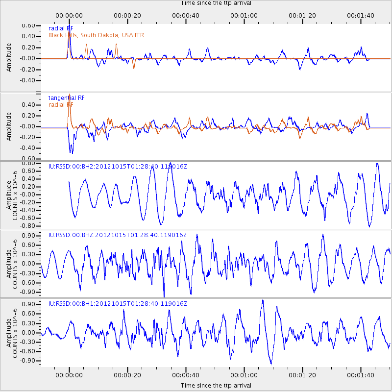
RSSD Black Hills, South Dakota, USA - Earthquake Result Viewer
*The percent match for this event was below the threshold and hence no stack was calculated.
| Earthquake location: |
Off East Coast Of Kamchatka |
| Earthquake latitude/longitude: |
51.9/159.4 |
| Earthquake time(UTC): |
2012/10/15 (289) 01:19:03 GMT |
| Earthquake Depth: |
21 km |
| Earthquake Magnitude: |
5.6 MW, 5.6 MW |
| Earthquake Catalog/Contributor: |
NEIC PDE/NEIC PDE-W |
|
| Network: |
IU Global Seismograph Network (GSN - IRIS/USGS) |
| Station: |
RSSD Black Hills, South Dakota, USA |
| Lat/Lon: |
44.12 N/104.04 W |
| Elevation: |
2090 m |
|
| Distance: |
60.4 deg |
| Az: |
55.339 deg |
| Baz: |
314.957 deg |
| Ray Param: |
$rayparam |
*The percent match for this event was below the threshold and hence was not used in the summary stack. |
|
| Radial Match: |
70.61629 % |
| Radial Bump: |
395 |
| Transverse Match: |
76.92958 % |
| Transverse Bump: |
400 |
| SOD ConfigId: |
558545 |
| Insert Time: |
2013-09-17 20:46:59.146 +0000 |
| GWidth: |
2.5 |
| Max Bumps: |
400 |
| Tol: |
0.001 |
|
Signal To Noise
| Channel | StoN | STA | LTA |
| IU:RSSD:00:BHZ:20121015T01:28:40.119016Z | 1.1166414 | 3.796337E-7 | 3.399782E-7 |
| IU:RSSD:00:BH1:20121015T01:28:40.119016Z | 1.2550691 | 2.611738E-7 | 2.0809516E-7 |
| IU:RSSD:00:BH2:20121015T01:28:40.119016Z | 2.0945742 | 5.502047E-7 | 2.6268094E-7 |
| Arrivals |
| Ps | |
| PpPs | |
| PsPs/PpSs | |


