You are here: Home > Network List > US - United States National Seismic Network Stations List
> Station BOZ Bozeman, Montana, USA > Earthquake Result Viewer
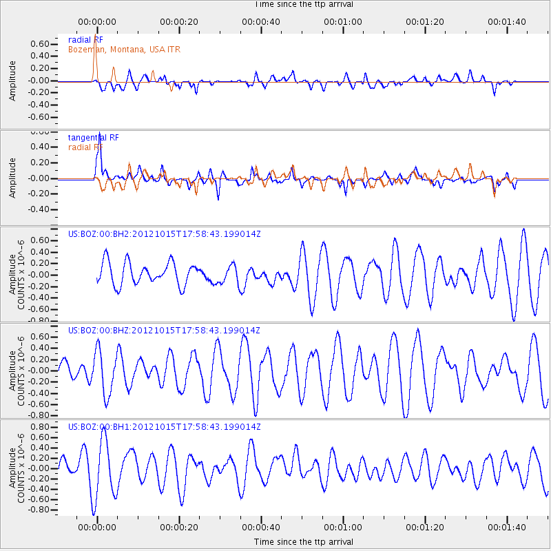
BOZ Bozeman, Montana, USA - Earthquake Result Viewer
*The percent match for this event was below the threshold and hence no stack was calculated.
| Earthquake location: |
Guatemala |
| Earthquake latitude/longitude: |
14.1/-91.0 |
| Earthquake time(UTC): |
2012/10/15 (289) 17:52:20 GMT |
| Earthquake Depth: |
82 km |
| Earthquake Magnitude: |
5.5 MW, 5.4 MB, 5.5 MW |
| Earthquake Catalog/Contributor: |
WHDF/NEIC |
|
| Network: |
US United States National Seismic Network |
| Station: |
BOZ Bozeman, Montana, USA |
| Lat/Lon: |
45.65 N/111.63 W |
| Elevation: |
1589 m |
|
| Distance: |
36.0 deg |
| Az: |
335.137 deg |
| Baz: |
144.434 deg |
| Ray Param: |
$rayparam |
*The percent match for this event was below the threshold and hence was not used in the summary stack. |
|
| Radial Match: |
42.112072 % |
| Radial Bump: |
400 |
| Transverse Match: |
71.55379 % |
| Transverse Bump: |
400 |
| SOD ConfigId: |
558545 |
| Insert Time: |
2013-09-17 20:51:04.109 +0000 |
| GWidth: |
2.5 |
| Max Bumps: |
400 |
| Tol: |
0.001 |
|
Signal To Noise
| Channel | StoN | STA | LTA |
| US:BOZ:00:BHZ:20121015T17:58:43.199014Z | 1.7184467 | 3.9348708E-7 | 2.2897834E-7 |
| US:BOZ:00:BH1:20121015T17:58:43.199014Z | 2.4860036 | 5.794261E-7 | 2.3307533E-7 |
| US:BOZ:00:BH2:20121015T17:58:43.199014Z | 0.91244346 | 1.7456365E-7 | 1.9131448E-7 |
| Arrivals |
| Ps | |
| PpPs | |
| PsPs/PpSs | |


