You are here: Home > Network List > US - United States National Seismic Network Stations List
> Station COWI Conover, Wisconsin, USA > Earthquake Result Viewer
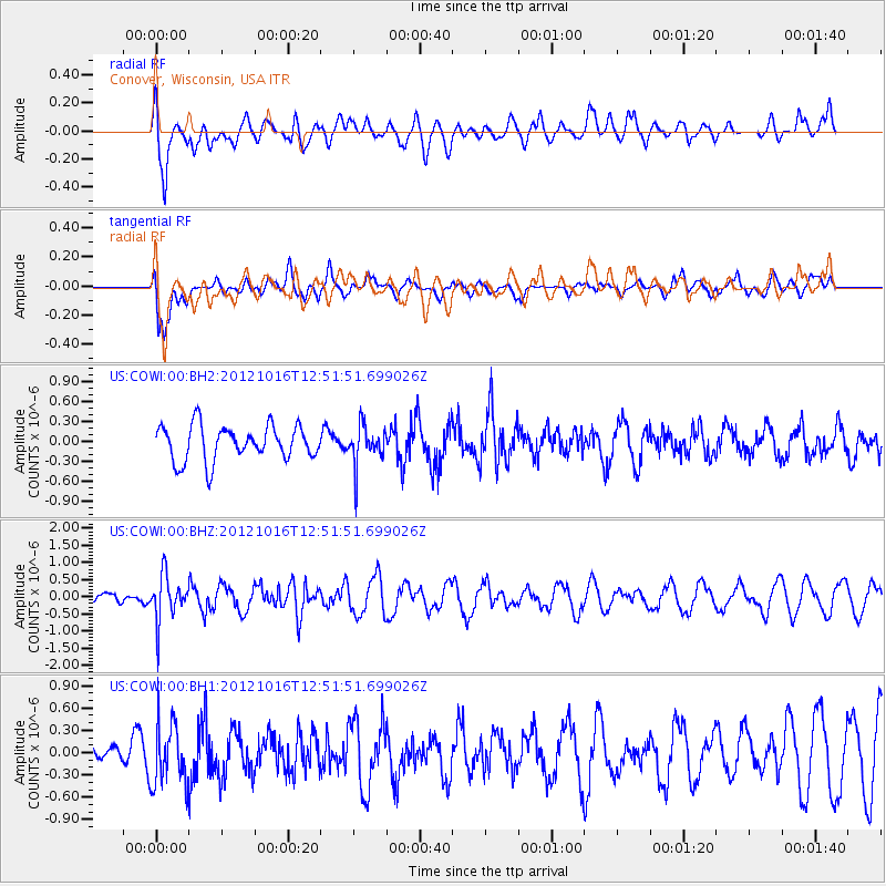
COWI Conover, Wisconsin, USA - Earthquake Result Viewer
*The percent match for this event was below the threshold and hence no stack was calculated.
| Earthquake location: |
Kuril Islands |
| Earthquake latitude/longitude: |
49.6/156.4 |
| Earthquake time(UTC): |
2012/10/16 (290) 12:41:25 GMT |
| Earthquake Depth: |
81 km |
| Earthquake Magnitude: |
6.2 MB, 5.6 MW, 5.6 MW |
| Earthquake Catalog/Contributor: |
WHDF/NEIC |
|
| Network: |
US United States National Seismic Network |
| Station: |
COWI Conover, Wisconsin, USA |
| Lat/Lon: |
46.10 N/89.14 W |
| Elevation: |
523 m |
|
| Distance: |
69.0 deg |
| Az: |
42.736 deg |
| Baz: |
320.629 deg |
| Ray Param: |
$rayparam |
*The percent match for this event was below the threshold and hence was not used in the summary stack. |
|
| Radial Match: |
65.27902 % |
| Radial Bump: |
400 |
| Transverse Match: |
67.75981 % |
| Transverse Bump: |
400 |
| SOD ConfigId: |
558545 |
| Insert Time: |
2013-09-17 20:55:31.889 +0000 |
| GWidth: |
2.5 |
| Max Bumps: |
400 |
| Tol: |
0.001 |
|
Signal To Noise
| Channel | StoN | STA | LTA |
| US:COWI:00:BHZ:20121016T12:51:51.699026Z | 3.6360707 | 6.6578366E-7 | 1.8310526E-7 |
| US:COWI:00:BH1:20121016T12:51:51.699026Z | 1.6205659 | 4.07374E-7 | 2.5137763E-7 |
| US:COWI:00:BH2:20121016T12:51:51.699026Z | 1.1402179 | 2.9546834E-7 | 2.591332E-7 |
| Arrivals |
| Ps | |
| PpPs | |
| PsPs/PpSs | |


