You are here: Home > Network List > US - United States National Seismic Network Stations List
> Station GOGA Godfrey, Georgia, USA > Earthquake Result Viewer
GOGA Godfrey, Georgia, USA - Earthquake Result Viewer
*The percent match for this event was below the threshold and hence no stack was calculated.
| Earthquake location: |
Kuril Islands |
| Earthquake latitude/longitude: |
49.6/156.4 |
| Earthquake time(UTC): |
2012/10/16 (290) 12:41:25 GMT |
| Earthquake Depth: |
81 km |
| Earthquake Magnitude: |
6.2 MB, 5.6 MW, 5.6 MW |
| Earthquake Catalog/Contributor: |
WHDF/NEIC |
|
| Network: |
US United States National Seismic Network |
| Station: |
GOGA Godfrey, Georgia, USA |
| Lat/Lon: |
33.41 N/83.47 W |
| Elevation: |
150 m |
|
| Distance: |
81.7 deg |
| Az: |
46.991 deg |
| Baz: |
325.347 deg |
| Ray Param: |
$rayparam |
*The percent match for this event was below the threshold and hence was not used in the summary stack. |
|
| Radial Match: |
62.364883 % |
| Radial Bump: |
400 |
| Transverse Match: |
69.14911 % |
| Transverse Bump: |
400 |
| SOD ConfigId: |
558545 |
| Insert Time: |
2013-09-17 20:56:00.767 +0000 |
| GWidth: |
2.5 |
| Max Bumps: |
400 |
| Tol: |
0.001 |
|
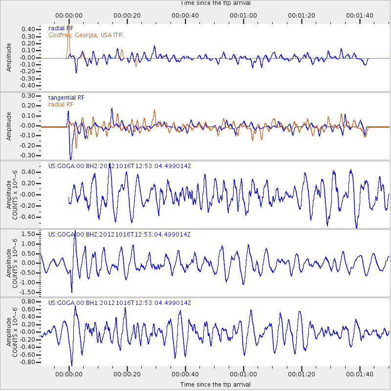
Signal To Noise
| Channel | StoN | STA | LTA |
| US:GOGA:00:BHZ:20121016T12:53:04.499014Z | 2.3100564 | 7.3122067E-7 | 3.16538E-7 |
| US:GOGA:00:BH1:20121016T12:53:04.499014Z | 2.7674403 | 4.4619912E-7 | 1.6123171E-7 |
| US:GOGA:00:BH2:20121016T12:53:04.499014Z | 0.6756746 | 1.612839E-7 | 2.3870052E-7 |
| Arrivals |
| Ps | |
| PpPs | |
| PsPs/PpSs | |


