You are here: Home > Network List > US - United States National Seismic Network Stations List
> Station LONY Lake Ozonia, New York, USA > Earthquake Result Viewer
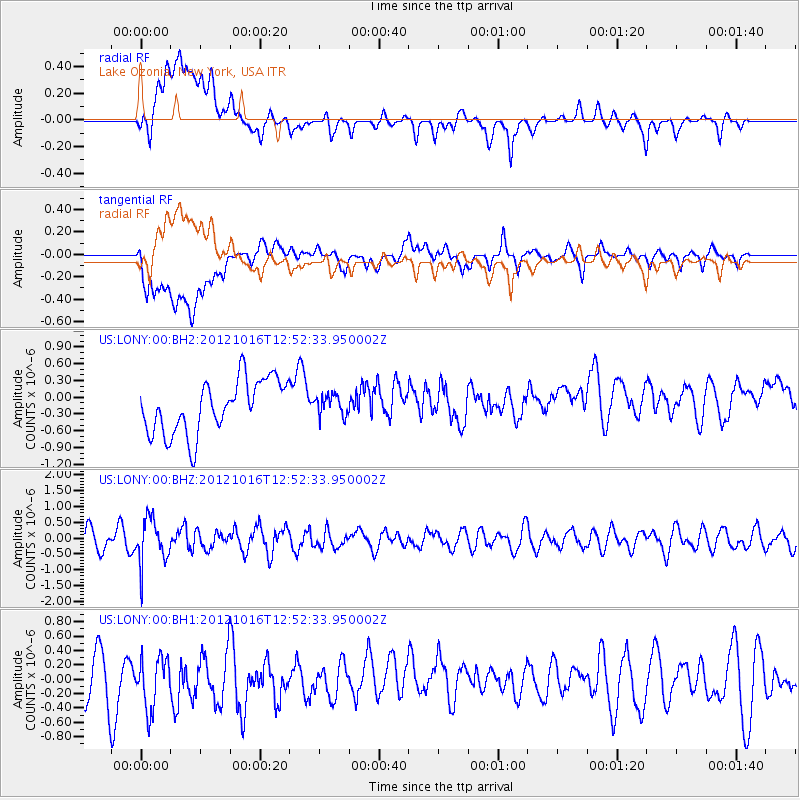
LONY Lake Ozonia, New York, USA - Earthquake Result Viewer
*The percent match for this event was below the threshold and hence no stack was calculated.
| Earthquake location: |
Kuril Islands |
| Earthquake latitude/longitude: |
49.6/156.4 |
| Earthquake time(UTC): |
2012/10/16 (290) 12:41:25 GMT |
| Earthquake Depth: |
81 km |
| Earthquake Magnitude: |
6.2 MB, 5.6 MW, 5.6 MW |
| Earthquake Catalog/Contributor: |
WHDF/NEIC |
|
| Network: |
US United States National Seismic Network |
| Station: |
LONY Lake Ozonia, New York, USA |
| Lat/Lon: |
44.62 N/74.58 W |
| Elevation: |
440 m |
|
| Distance: |
76.1 deg |
| Az: |
34.876 deg |
| Baz: |
328.616 deg |
| Ray Param: |
$rayparam |
*The percent match for this event was below the threshold and hence was not used in the summary stack. |
|
| Radial Match: |
47.035267 % |
| Radial Bump: |
400 |
| Transverse Match: |
52.57233 % |
| Transverse Bump: |
400 |
| SOD ConfigId: |
558545 |
| Insert Time: |
2013-09-17 20:56:45.644 +0000 |
| GWidth: |
2.5 |
| Max Bumps: |
400 |
| Tol: |
0.001 |
|
Signal To Noise
| Channel | StoN | STA | LTA |
| US:LONY:00:BHZ:20121016T12:52:33.950002Z | 2.2179267 | 7.110302E-7 | 3.205833E-7 |
| US:LONY:00:BH1:20121016T12:52:33.950002Z | 1.1416475 | 3.7415083E-7 | 3.2772888E-7 |
| US:LONY:00:BH2:20121016T12:52:33.950002Z | 0.39513776 | 1.8871548E-7 | 4.7759414E-7 |
| Arrivals |
| Ps | |
| PpPs | |
| PsPs/PpSs | |


