You are here: Home > Network List > US - United States National Seismic Network Stations List
> Station VBMS Vicksburg, Mississippi > Earthquake Result Viewer
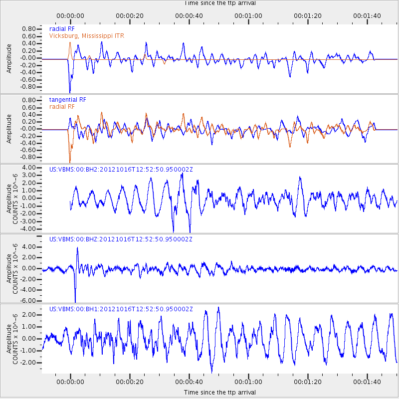
VBMS Vicksburg, Mississippi - Earthquake Result Viewer
*The percent match for this event was below the threshold and hence no stack was calculated.
| Earthquake location: |
Kuril Islands |
| Earthquake latitude/longitude: |
49.6/156.4 |
| Earthquake time(UTC): |
2012/10/16 (290) 12:41:25 GMT |
| Earthquake Depth: |
81 km |
| Earthquake Magnitude: |
6.2 MB, 5.6 MW, 5.6 MW |
| Earthquake Catalog/Contributor: |
WHDF/NEIC |
|
| Network: |
US United States National Seismic Network |
| Station: |
VBMS Vicksburg, Mississippi |
| Lat/Lon: |
32.22 N/90.52 W |
| Elevation: |
0.0 m |
|
| Distance: |
79.2 deg |
| Az: |
52.564 deg |
| Baz: |
322.463 deg |
| Ray Param: |
$rayparam |
*The percent match for this event was below the threshold and hence was not used in the summary stack. |
|
| Radial Match: |
38.428417 % |
| Radial Bump: |
395 |
| Transverse Match: |
46.501396 % |
| Transverse Bump: |
346 |
| SOD ConfigId: |
558545 |
| Insert Time: |
2013-09-17 20:57:50.158 +0000 |
| GWidth: |
2.5 |
| Max Bumps: |
400 |
| Tol: |
0.001 |
|
Signal To Noise
| Channel | StoN | STA | LTA |
| US:VBMS:00:BHZ:20121016T12:52:50.950002Z | 7.8807898 | 1.7816475E-6 | 2.2607475E-7 |
| US:VBMS:00:BH1:20121016T12:52:50.950002Z | 0.9425344 | 6.5659486E-7 | 6.9662696E-7 |
| US:VBMS:00:BH2:20121016T12:52:50.950002Z | 1.97577 | 1.8514286E-6 | 9.3706683E-7 |
| Arrivals |
| Ps | |
| PpPs | |
| PsPs/PpSs | |


