You are here: Home > Network List > US - United States National Seismic Network Stations List
> Station WMOK Wichita Mountains, Oklahoma, USA > Earthquake Result Viewer
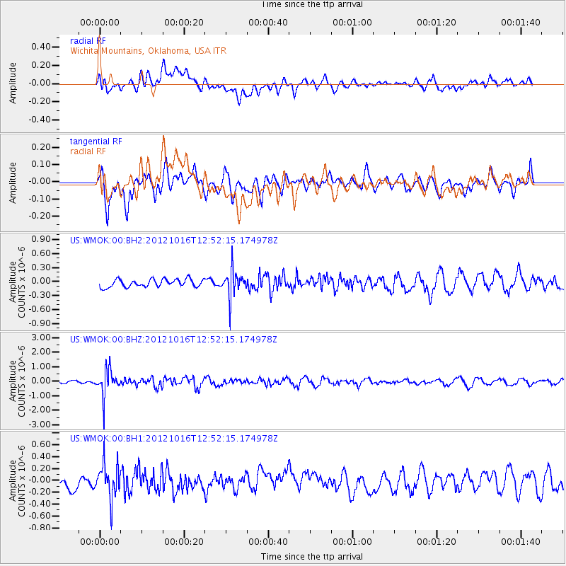
WMOK Wichita Mountains, Oklahoma, USA - Earthquake Result Viewer
*The percent match for this event was below the threshold and hence no stack was calculated.
| Earthquake location: |
Kuril Islands |
| Earthquake latitude/longitude: |
49.6/156.4 |
| Earthquake time(UTC): |
2012/10/16 (290) 12:41:25 GMT |
| Earthquake Depth: |
81 km |
| Earthquake Magnitude: |
6.2 MB, 5.6 MW, 5.6 MW |
| Earthquake Catalog/Contributor: |
WHDF/NEIC |
|
| Network: |
US United States National Seismic Network |
| Station: |
WMOK Wichita Mountains, Oklahoma, USA |
| Lat/Lon: |
34.74 N/98.78 W |
| Elevation: |
486 m |
|
| Distance: |
72.9 deg |
| Az: |
56.426 deg |
| Baz: |
318.852 deg |
| Ray Param: |
$rayparam |
*The percent match for this event was below the threshold and hence was not used in the summary stack. |
|
| Radial Match: |
52.526154 % |
| Radial Bump: |
400 |
| Transverse Match: |
66.28989 % |
| Transverse Bump: |
400 |
| SOD ConfigId: |
558545 |
| Insert Time: |
2013-09-17 20:57:54.411 +0000 |
| GWidth: |
2.5 |
| Max Bumps: |
400 |
| Tol: |
0.001 |
|
Signal To Noise
| Channel | StoN | STA | LTA |
| US:WMOK:00:BHZ:20121016T12:52:15.174978Z | 5.371129 | 9.0581466E-7 | 1.6864512E-7 |
| US:WMOK:00:BH1:20121016T12:52:15.174978Z | 2.0198948 | 2.7802707E-7 | 1.3764434E-7 |
| US:WMOK:00:BH2:20121016T12:52:15.174978Z | 3.4775994 | 2.8941312E-7 | 8.32221E-8 |
| Arrivals |
| Ps | |
| PpPs | |
| PsPs/PpSs | |


