You are here: Home > Network List > II - Global Seismograph Network (GSN - IRIS/IDA) Stations List
> Station WRAB Tennant Creek, NT, Australia > Earthquake Result Viewer
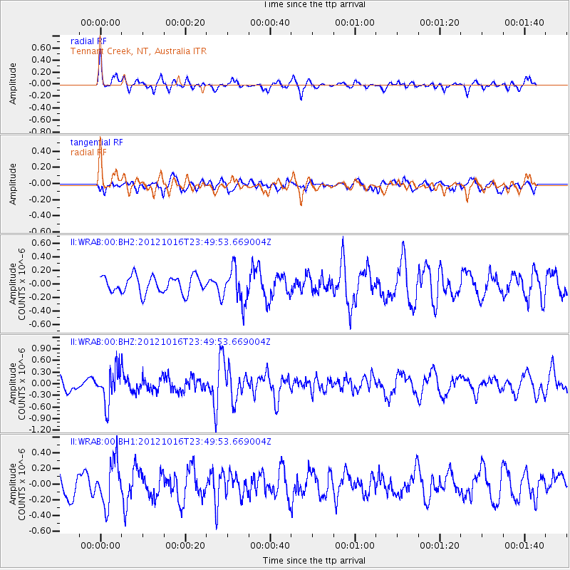
WRAB Tennant Creek, NT, Australia - Earthquake Result Viewer
*The percent match for this event was below the threshold and hence no stack was calculated.
| Earthquake location: |
North Island, New Zealand |
| Earthquake latitude/longitude: |
-38.6/176.2 |
| Earthquake time(UTC): |
2012/10/16 (290) 23:42:55 GMT |
| Earthquake Depth: |
110 km |
| Earthquake Magnitude: |
5.6 MW, 5.2 MB, 5.7 MW |
| Earthquake Catalog/Contributor: |
WHDF/NEIC |
|
| Network: |
II Global Seismograph Network (GSN - IRIS/IDA) |
| Station: |
WRAB Tennant Creek, NT, Australia |
| Lat/Lon: |
19.93 S/134.36 E |
| Elevation: |
366 m |
|
| Distance: |
40.5 deg |
| Az: |
285.224 deg |
| Baz: |
126.564 deg |
| Ray Param: |
$rayparam |
*The percent match for this event was below the threshold and hence was not used in the summary stack. |
|
| Radial Match: |
56.03742 % |
| Radial Bump: |
400 |
| Transverse Match: |
64.18516 % |
| Transverse Bump: |
400 |
| SOD ConfigId: |
558545 |
| Insert Time: |
2013-09-17 20:58:54.015 +0000 |
| GWidth: |
2.5 |
| Max Bumps: |
400 |
| Tol: |
0.001 |
|
Signal To Noise
| Channel | StoN | STA | LTA |
| II:WRAB:00:BHZ:20121016T23:49:53.669004Z | 3.1219435 | 4.494041E-7 | 1.439501E-7 |
| II:WRAB:00:BH1:20121016T23:49:53.669004Z | 1.8694614 | 2.8311106E-7 | 1.514399E-7 |
| II:WRAB:00:BH2:20121016T23:49:53.669004Z | 2.000977 | 2.5101593E-7 | 1.2544668E-7 |
| Arrivals |
| Ps | |
| PpPs | |
| PsPs/PpSs | |


