You are here: Home > Network List > IU - Global Seismograph Network (GSN - IRIS/USGS) Stations List
> Station HNR Honiara, Solomon Islands > Earthquake Result Viewer
HNR Honiara, Solomon Islands - Earthquake Result Viewer
*The percent match for this event was below the threshold and hence no stack was calculated.
| Earthquake location: |
North Island, New Zealand |
| Earthquake latitude/longitude: |
-38.6/176.2 |
| Earthquake time(UTC): |
2012/10/16 (290) 23:42:55 GMT |
| Earthquake Depth: |
110 km |
| Earthquake Magnitude: |
5.6 MW, 5.2 MB, 5.7 MW |
| Earthquake Catalog/Contributor: |
WHDF/NEIC |
|
| Network: |
IU Global Seismograph Network (GSN - IRIS/USGS) |
| Station: |
HNR Honiara, Solomon Islands |
| Lat/Lon: |
9.44 S/159.95 E |
| Elevation: |
100 m |
|
| Distance: |
32.5 deg |
| Az: |
329.158 deg |
| Baz: |
155.988 deg |
| Ray Param: |
$rayparam |
*The percent match for this event was below the threshold and hence was not used in the summary stack. |
|
| Radial Match: |
28.166374 % |
| Radial Bump: |
400 |
| Transverse Match: |
48.030678 % |
| Transverse Bump: |
400 |
| SOD ConfigId: |
558545 |
| Insert Time: |
2013-09-17 20:59:40.978 +0000 |
| GWidth: |
2.5 |
| Max Bumps: |
400 |
| Tol: |
0.001 |
|
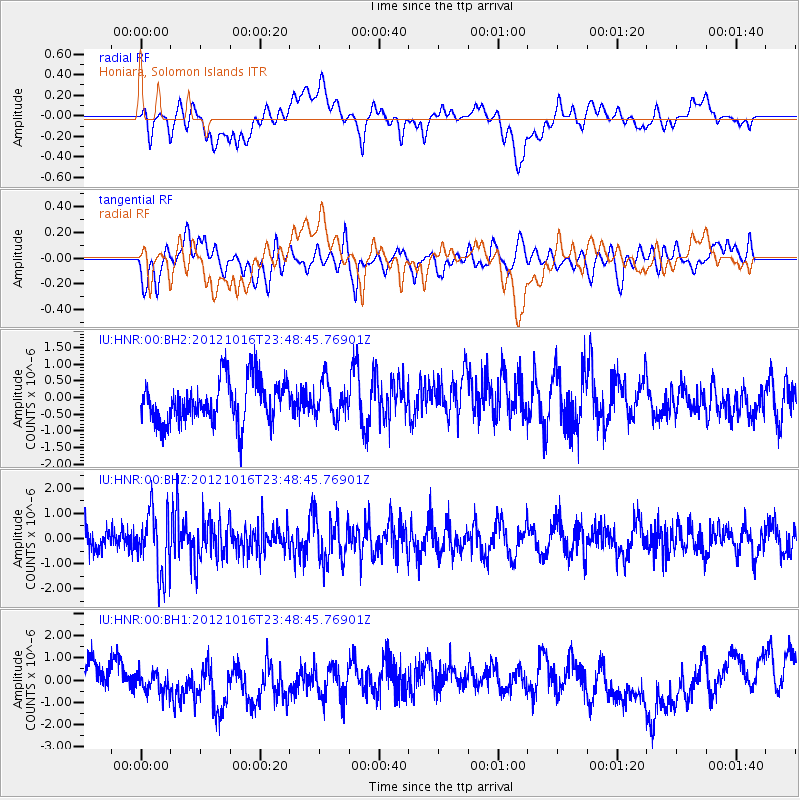
Signal To Noise
| Channel | StoN | STA | LTA |
| IU:HNR:00:BHZ:20121016T23:48:45.76901Z | 3.0392318 | 1.2594335E-6 | 4.1439205E-7 |
| IU:HNR:00:BH1:20121016T23:48:45.76901Z | 1.201456 | 7.225621E-7 | 6.014054E-7 |
| IU:HNR:00:BH2:20121016T23:48:45.76901Z | 0.7915922 | 5.073946E-7 | 6.4097975E-7 |
| Arrivals |
| Ps | |
| PpPs | |
| PsPs/PpSs | |


