You are here: Home > Network List > IU - Global Seismograph Network (GSN - IRIS/USGS) Stations List
> Station CTAO Charters Towers, Australia > Earthquake Result Viewer
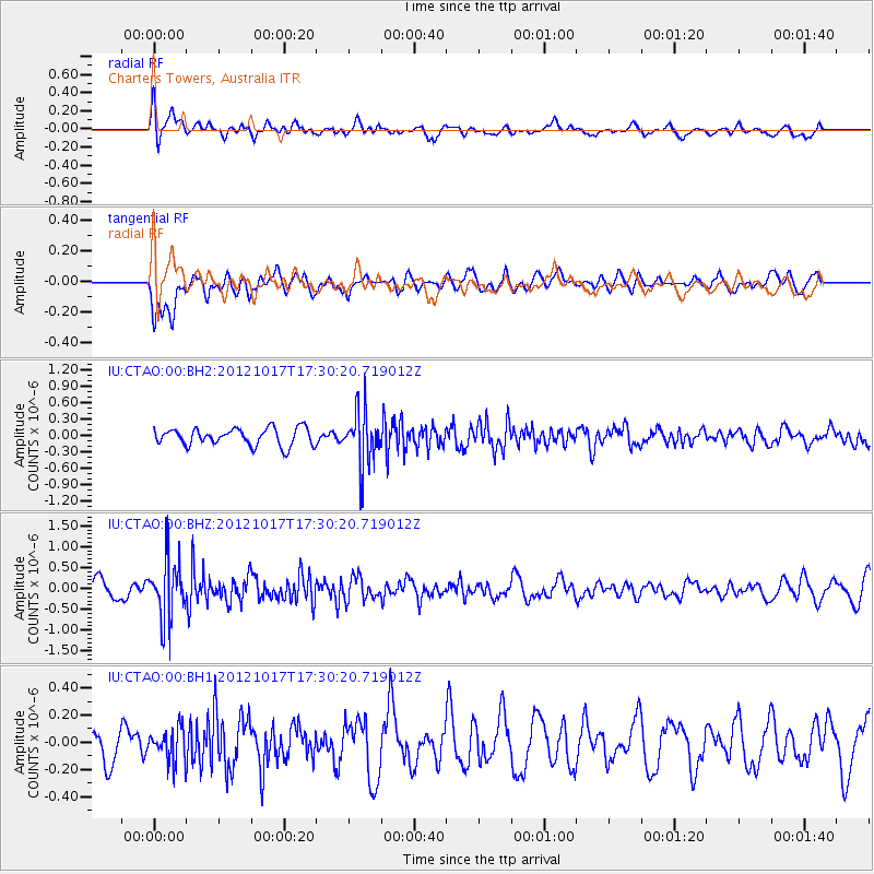
CTAO Charters Towers, Australia - Earthquake Result Viewer
*The percent match for this event was below the threshold and hence no stack was calculated.
| Earthquake location: |
Tonga Islands |
| Earthquake latitude/longitude: |
-19.0/-174.2 |
| Earthquake time(UTC): |
2012/10/17 (291) 17:23:42 GMT |
| Earthquake Depth: |
35 km |
| Earthquake Magnitude: |
5.5 MB, 5.0 MS, 5.4 MW |
| Earthquake Catalog/Contributor: |
WHDF/NEIC |
|
| Network: |
IU Global Seismograph Network (GSN - IRIS/USGS) |
| Station: |
CTAO Charters Towers, Australia |
| Lat/Lon: |
20.09 S/146.25 E |
| Elevation: |
357 m |
|
| Distance: |
37.2 deg |
| Az: |
261.639 deg |
| Baz: |
95.292 deg |
| Ray Param: |
$rayparam |
*The percent match for this event was below the threshold and hence was not used in the summary stack. |
|
| Radial Match: |
58.277565 % |
| Radial Bump: |
400 |
| Transverse Match: |
52.387432 % |
| Transverse Bump: |
400 |
| SOD ConfigId: |
558545 |
| Insert Time: |
2013-09-17 21:04:05.163 +0000 |
| GWidth: |
2.5 |
| Max Bumps: |
400 |
| Tol: |
0.001 |
|
Signal To Noise
| Channel | StoN | STA | LTA |
| IU:CTAO:00:BHZ:20121017T17:30:20.719012Z | 2.9431486 | 7.198503E-7 | 2.4458507E-7 |
| IU:CTAO:00:BH1:20121017T17:30:20.719012Z | 0.78532434 | 1.2072321E-7 | 1.5372402E-7 |
| IU:CTAO:00:BH2:20121017T17:30:20.719012Z | 3.1527052 | 4.9703584E-7 | 1.5765376E-7 |
| Arrivals |
| Ps | |
| PpPs | |
| PsPs/PpSs | |


