You are here: Home > Network List > II - Global Seismograph Network (GSN - IRIS/IDA) Stations List
> Station KAPI Kappang, Sulawesi, Indonesia > Earthquake Result Viewer
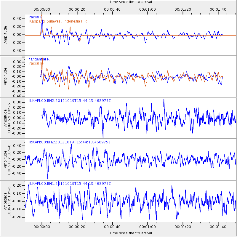
KAPI Kappang, Sulawesi, Indonesia - Earthquake Result Viewer
*The percent match for this event was below the threshold and hence no stack was calculated.
| Earthquake location: |
Kermadec Islands Region |
| Earthquake latitude/longitude: |
-30.8/-176.8 |
| Earthquake time(UTC): |
2012/10/19 (293) 15:34:09 GMT |
| Earthquake Depth: |
35 km |
| Earthquake Magnitude: |
5.5 MB |
| Earthquake Catalog/Contributor: |
NEIC PDE/NEIC PDE-W |
|
| Network: |
II Global Seismograph Network (GSN - IRIS/IDA) |
| Station: |
KAPI Kappang, Sulawesi, Indonesia |
| Lat/Lon: |
5.01 S/119.75 E |
| Elevation: |
300 m |
|
| Distance: |
64.7 deg |
| Az: |
279.695 deg |
| Baz: |
121.645 deg |
| Ray Param: |
$rayparam |
*The percent match for this event was below the threshold and hence was not used in the summary stack. |
|
| Radial Match: |
56.800312 % |
| Radial Bump: |
400 |
| Transverse Match: |
49.524593 % |
| Transverse Bump: |
400 |
| SOD ConfigId: |
558545 |
| Insert Time: |
2013-09-17 21:11:17.628 +0000 |
| GWidth: |
2.5 |
| Max Bumps: |
400 |
| Tol: |
0.001 |
|
Signal To Noise
| Channel | StoN | STA | LTA |
| II:KAPI:00:BHZ:20121019T15:44:13.468975Z | 2.0908334 | 2.1821529E-7 | 1.04367615E-7 |
| II:KAPI:00:BH1:20121019T15:44:13.468975Z | 0.8780014 | 5.144582E-8 | 5.859423E-8 |
| II:KAPI:00:BH2:20121019T15:44:13.468975Z | 2.0333319 | 1.479788E-7 | 7.277651E-8 |
| Arrivals |
| Ps | |
| PpPs | |
| PsPs/PpSs | |


