You are here: Home > Network List > IU - Global Seismograph Network (GSN - IRIS/USGS) Stations List
> Station POHA Pohakuloa, Hawaii, USA > Earthquake Result Viewer
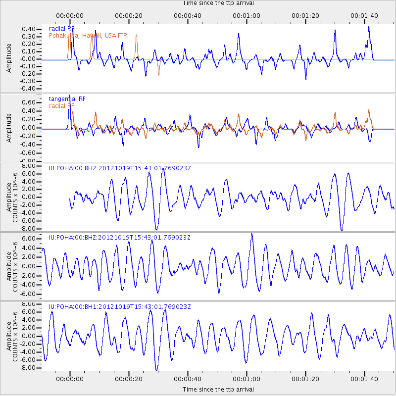
POHA Pohakuloa, Hawaii, USA - Earthquake Result Viewer
*The percent match for this event was below the threshold and hence no stack was calculated.
| Earthquake location: |
Kermadec Islands Region |
| Earthquake latitude/longitude: |
-30.8/-176.8 |
| Earthquake time(UTC): |
2012/10/19 (293) 15:34:09 GMT |
| Earthquake Depth: |
35 km |
| Earthquake Magnitude: |
5.5 MB |
| Earthquake Catalog/Contributor: |
NEIC PDE/NEIC PDE-W |
|
| Network: |
IU Global Seismograph Network (GSN - IRIS/USGS) |
| Station: |
POHA Pohakuloa, Hawaii, USA |
| Lat/Lon: |
19.76 N/155.53 W |
| Elevation: |
1990 m |
|
| Distance: |
54.3 deg |
| Az: |
24.886 deg |
| Baz: |
202.608 deg |
| Ray Param: |
$rayparam |
*The percent match for this event was below the threshold and hence was not used in the summary stack. |
|
| Radial Match: |
62.483543 % |
| Radial Bump: |
372 |
| Transverse Match: |
59.58203 % |
| Transverse Bump: |
400 |
| SOD ConfigId: |
558545 |
| Insert Time: |
2013-09-17 21:12:30.620 +0000 |
| GWidth: |
2.5 |
| Max Bumps: |
400 |
| Tol: |
0.001 |
|
Signal To Noise
| Channel | StoN | STA | LTA |
| IU:POHA:00:BHZ:20121019T15:43:01.769023Z | 0.8555687 | 1.5561768E-6 | 1.81888E-6 |
| IU:POHA:00:BH1:20121019T15:43:01.769023Z | 0.44675797 | 1.2259505E-6 | 2.7441044E-6 |
| IU:POHA:00:BH2:20121019T15:43:01.769023Z | 2.15262 | 5.161486E-6 | 2.397769E-6 |
| Arrivals |
| Ps | |
| PpPs | |
| PsPs/PpSs | |


