You are here: Home > Network List > TA - USArray Transportable Network (new EarthScope stations) Stations List
> Station Q53A Leroy, WV, USA > Earthquake Result Viewer
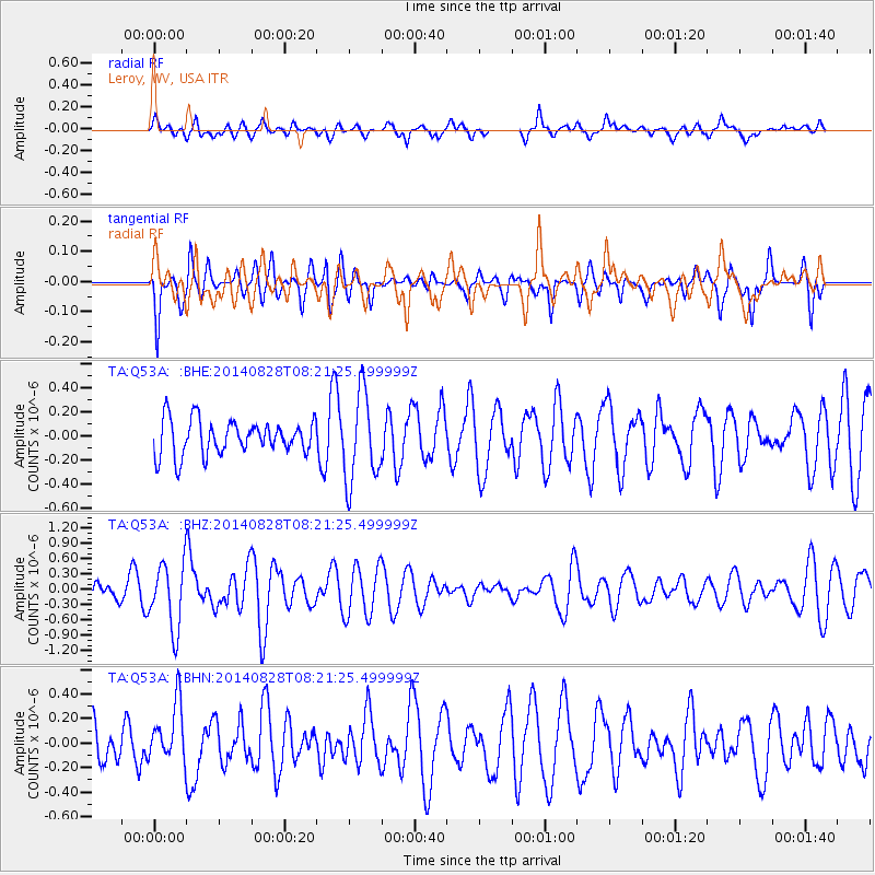
Q53A Leroy, WV, USA - Earthquake Result Viewer
*The percent match for this event was below the threshold and hence no stack was calculated.
| Earthquake location: |
Iceland |
| Earthquake latitude/longitude: |
64.7/-17.4 |
| Earthquake time(UTC): |
2014/08/28 (240) 08:13:42 GMT |
| Earthquake Depth: |
4.0 km |
| Earthquake Magnitude: |
5.4 MW, 5.0 mb, 5.0 Ms_20, 5.4 Mwb, 5.4 Mww, 5.5 Mwc |
| Earthquake Catalog/Contributor: |
ISC/ISC |
|
| Network: |
TA USArray Transportable Network (new EarthScope stations) |
| Station: |
Q53A Leroy, WV, USA |
| Lat/Lon: |
38.86 N/81.53 W |
| Elevation: |
310 m |
|
| Distance: |
44.7 deg |
| Az: |
266.828 deg |
| Baz: |
33.345 deg |
| Ray Param: |
$rayparam |
*The percent match for this event was below the threshold and hence was not used in the summary stack. |
|
| Radial Match: |
49.927986 % |
| Radial Bump: |
400 |
| Transverse Match: |
50.24073 % |
| Transverse Bump: |
341 |
| SOD ConfigId: |
3390531 |
| Insert Time: |
2019-04-13 16:30:25.160 +0000 |
| GWidth: |
2.5 |
| Max Bumps: |
400 |
| Tol: |
0.001 |
|
Signal To Noise
| Channel | StoN | STA | LTA |
| TA:Q53A: :BHZ:20140828T08:21:25.499999Z | 2.2506263 | 6.483673E-7 | 2.8808304E-7 |
| TA:Q53A: :BHN:20140828T08:21:25.499999Z | 1.5997735 | 2.4024277E-7 | 1.5017298E-7 |
| TA:Q53A: :BHE:20140828T08:21:25.499999Z | 2.5649457 | 3.661511E-7 | 1.42752E-7 |
| Arrivals |
| Ps | |
| PpPs | |
| PsPs/PpSs | |


