You are here: Home > Network List > IU - Global Seismograph Network (GSN - IRIS/USGS) Stations List
> Station RSSD Black Hills, South Dakota, USA > Earthquake Result Viewer
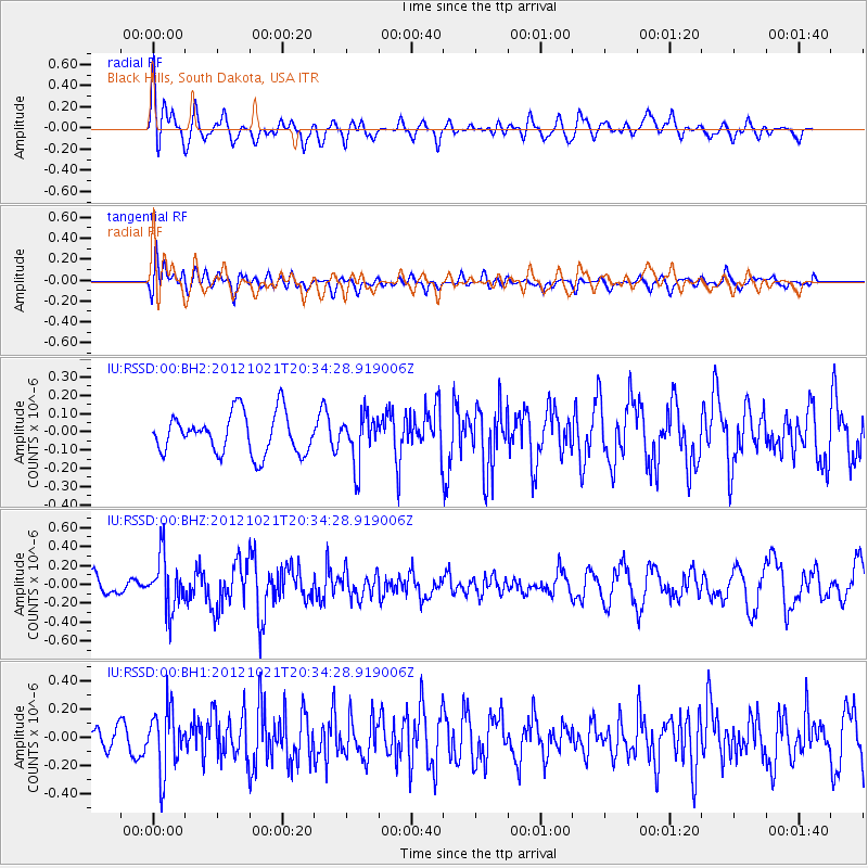
RSSD Black Hills, South Dakota, USA - Earthquake Result Viewer
*The percent match for this event was below the threshold and hence no stack was calculated.
| Earthquake location: |
Off Coast Of Central America |
| Earthquake latitude/longitude: |
12.6/-88.3 |
| Earthquake time(UTC): |
2012/10/21 (295) 20:28:17 GMT |
| Earthquake Depth: |
36 km |
| Earthquake Magnitude: |
5.5 MW, 5.5 MB |
| Earthquake Catalog/Contributor: |
NEIC PDE/NEIC PDE-W |
|
| Network: |
IU Global Seismograph Network (GSN - IRIS/USGS) |
| Station: |
RSSD Black Hills, South Dakota, USA |
| Lat/Lon: |
44.12 N/104.04 W |
| Elevation: |
2090 m |
|
| Distance: |
34.2 deg |
| Az: |
339.726 deg |
| Baz: |
151.981 deg |
| Ray Param: |
$rayparam |
*The percent match for this event was below the threshold and hence was not used in the summary stack. |
|
| Radial Match: |
62.328823 % |
| Radial Bump: |
400 |
| Transverse Match: |
58.663067 % |
| Transverse Bump: |
400 |
| SOD ConfigId: |
558545 |
| Insert Time: |
2013-09-17 21:24:20.675 +0000 |
| GWidth: |
2.5 |
| Max Bumps: |
400 |
| Tol: |
0.001 |
|
Signal To Noise
| Channel | StoN | STA | LTA |
| IU:RSSD:00:BHZ:20121021T20:34:28.919006Z | 1.7472928 | 2.791685E-7 | 1.5977203E-7 |
| IU:RSSD:00:BH1:20121021T20:34:28.919006Z | 2.409027 | 2.1976743E-7 | 9.122663E-8 |
| IU:RSSD:00:BH2:20121021T20:34:28.919006Z | 1.2027193 | 1.3331841E-7 | 1.1084748E-7 |
| Arrivals |
| Ps | |
| PpPs | |
| PsPs/PpSs | |


