You are here: Home > Network List > US - United States National Seismic Network Stations List
> Station EGMT Eagleton, Montana, USA > Earthquake Result Viewer
EGMT Eagleton, Montana, USA - Earthquake Result Viewer
*The percent match for this event was below the threshold and hence no stack was calculated.
| Earthquake location: |
Southeast Of Honshu, Japan |
| Earthquake latitude/longitude: |
29.1/139.3 |
| Earthquake time(UTC): |
2012/10/23 (297) 08:53:38 GMT |
| Earthquake Depth: |
436 km |
| Earthquake Magnitude: |
6.0 MB, 5.9 MW, 6.0 MW |
| Earthquake Catalog/Contributor: |
WHDF/NEIC |
|
| Network: |
US United States National Seismic Network |
| Station: |
EGMT Eagleton, Montana, USA |
| Lat/Lon: |
48.02 N/109.75 W |
| Elevation: |
1055 m |
|
| Distance: |
81.5 deg |
| Az: |
39.322 deg |
| Baz: |
304.265 deg |
| Ray Param: |
$rayparam |
*The percent match for this event was below the threshold and hence was not used in the summary stack. |
|
| Radial Match: |
56.04036 % |
| Radial Bump: |
400 |
| Transverse Match: |
58.614803 % |
| Transverse Bump: |
400 |
| SOD ConfigId: |
558545 |
| Insert Time: |
2013-09-17 21:29:05.329 +0000 |
| GWidth: |
2.5 |
| Max Bumps: |
400 |
| Tol: |
0.001 |
|
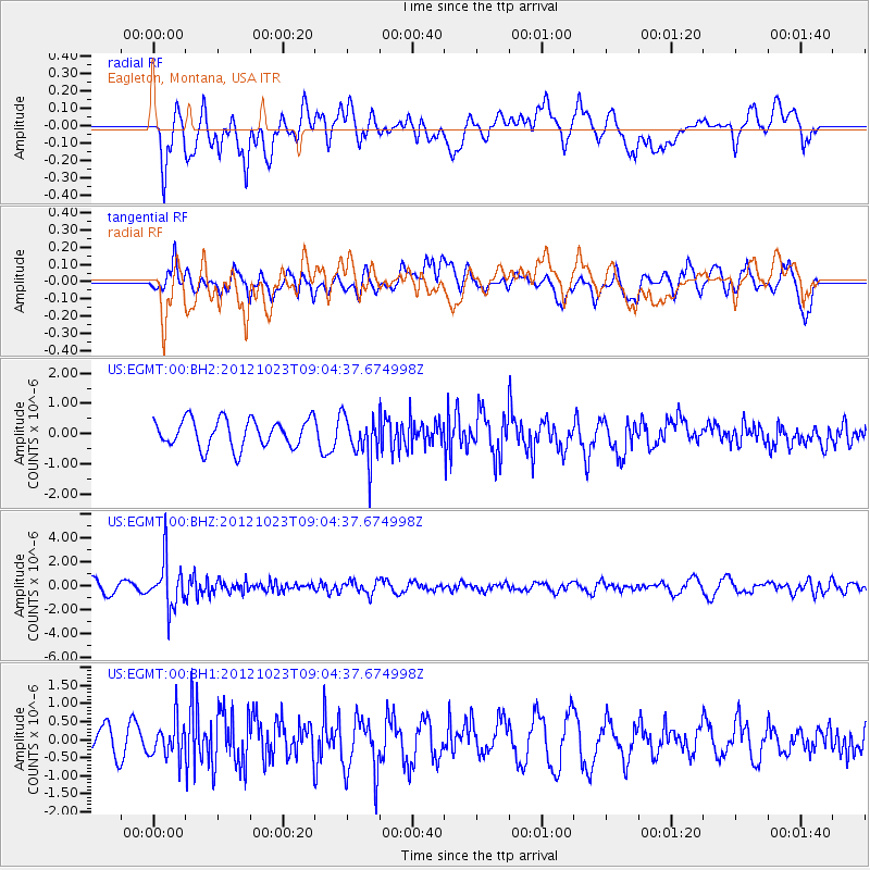
Signal To Noise
| Channel | StoN | STA | LTA |
| US:EGMT:00:BHZ:20121023T09:04:37.674998Z | 5.615256 | 1.981661E-6 | 3.5290662E-7 |
| US:EGMT:00:BH1:20121023T09:04:37.674998Z | 0.9390862 | 5.382002E-7 | 5.731105E-7 |
| US:EGMT:00:BH2:20121023T09:04:37.674998Z | 1.5733154 | 7.3028747E-7 | 4.6417105E-7 |
| Arrivals |
| Ps | |
| PpPs | |
| PsPs/PpSs | |


