You are here: Home > Network List > US - United States National Seismic Network Stations List
> Station HAWA Hanford, Washington, USA > Earthquake Result Viewer
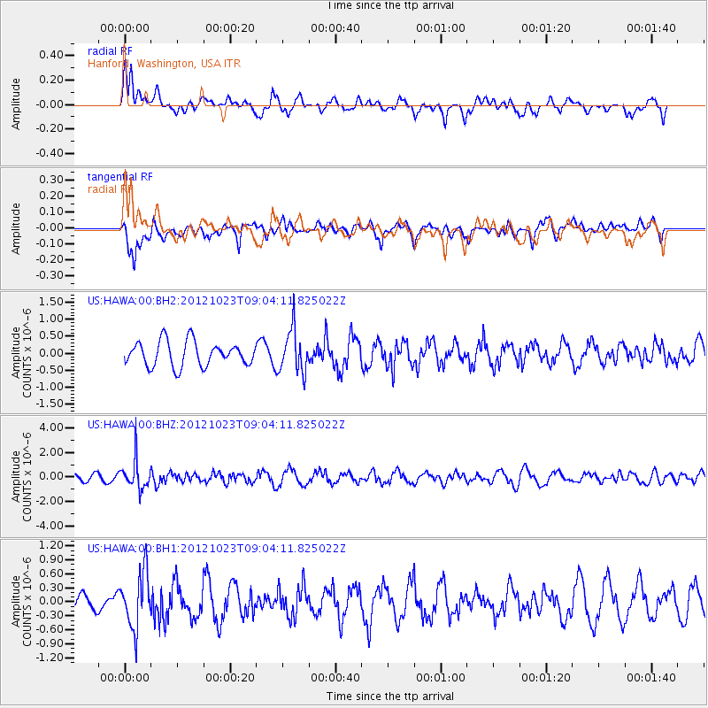
HAWA Hanford, Washington, USA - Earthquake Result Viewer
*The percent match for this event was below the threshold and hence no stack was calculated.
| Earthquake location: |
Southeast Of Honshu, Japan |
| Earthquake latitude/longitude: |
29.1/139.3 |
| Earthquake time(UTC): |
2012/10/23 (297) 08:53:38 GMT |
| Earthquake Depth: |
436 km |
| Earthquake Magnitude: |
6.0 MB, 5.9 MW, 6.0 MW |
| Earthquake Catalog/Contributor: |
WHDF/NEIC |
|
| Network: |
US United States National Seismic Network |
| Station: |
HAWA Hanford, Washington, USA |
| Lat/Lon: |
46.39 N/119.53 W |
| Elevation: |
364 m |
|
| Distance: |
76.7 deg |
| Az: |
44.248 deg |
| Baz: |
298.038 deg |
| Ray Param: |
$rayparam |
*The percent match for this event was below the threshold and hence was not used in the summary stack. |
|
| Radial Match: |
46.355354 % |
| Radial Bump: |
400 |
| Transverse Match: |
47.00778 % |
| Transverse Bump: |
400 |
| SOD ConfigId: |
558545 |
| Insert Time: |
2013-09-17 21:29:14.878 +0000 |
| GWidth: |
2.5 |
| Max Bumps: |
400 |
| Tol: |
0.001 |
|
Signal To Noise
| Channel | StoN | STA | LTA |
| US:HAWA:00:BHZ:20121023T09:04:11.825022Z | 3.5112038 | 1.2187539E-6 | 3.471043E-7 |
| US:HAWA:00:BH1:20121023T09:04:11.825022Z | 1.5662823 | 6.028943E-7 | 3.849206E-7 |
| US:HAWA:00:BH2:20121023T09:04:11.825022Z | 1.7631973 | 6.373465E-7 | 3.6147202E-7 |
| Arrivals |
| Ps | |
| PpPs | |
| PsPs/PpSs | |


