AAK Ala Archa, Kyrgyzstan - Earthquake Result Viewer
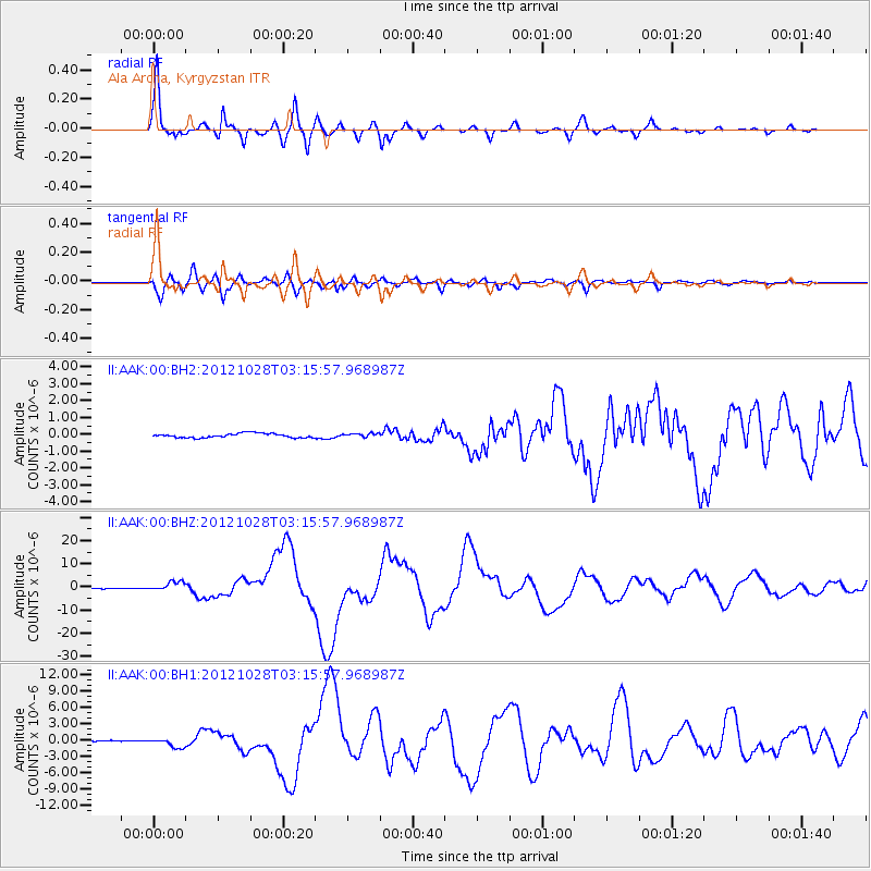
Earthquake location: Queen Charlotte Islands Region
Earthquake latitude/longitude: 52.8/-132.1
Earthquake time(UTC): 2012/10/28 (302) 03:04:08 GMT
Earthquake Depth: 14 km
Earthquake Magnitude: 6.5 MB, 7.5 MS, 7.8 MW, 7.8 MW
Earthquake Catalog/Contributor: WHDF/NEIC
Network: II Global Seismograph Network (GSN - IRIS/IDA)
Station: AAK Ala Archa, Kyrgyzstan
Lat/Lon: 42.64 N/74.49 E
Elevation: 1645 m
Distance: 82.2 deg
Az: 340.524 deg
Baz: 15.928 deg
Ray Param: 0.04703404
Estimated Moho Depth: 69.75 km
Estimated Crust Vp/Vs: 1.68
Assumed Crust Vp: 6.306 km/s
Estimated Crust Vs: 3.759 km/s
Estimated Crust Poisson's Ratio: 0.22
Radial Match: 97.86552 %
Radial Bump: 341
Transverse Match: 95.244835 %
Transverse Bump: 400
SOD ConfigId: 558545
Insert Time: 2013-09-17 21:48:27.760 +0000
GWidth: 2.5
Max Bumps: 400
Tol: 0.001

Signal To Noise

ChannelStoNSTALTA
II:AAK:00:BHZ:20121028T03:15:57.968987Z9.2818061.952292E-62.1033537E-7
II:AAK:00:BH1:20121028T03:15:57.968987Z8.2836058.2322475E-79.938002E-8
II:AAK:00:BH2:20121028T03:15:57.968987Z0.879005251.1010705E-71.2526324E-7
Arrivals
Ps7.7 SECOND
PpPs29 SECOND
PsPs/PpSs37 SECOND