KEV Kevo, Finland - Earthquake Result Viewer
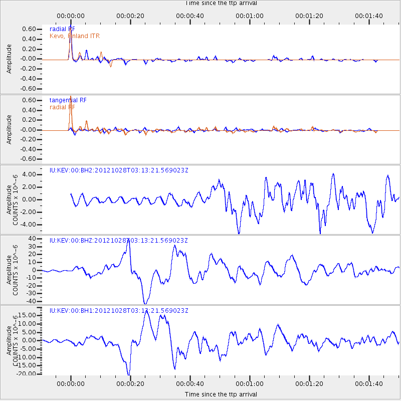
Earthquake location: Queen Charlotte Islands Region
Earthquake latitude/longitude: 52.8/-132.1
Earthquake time(UTC): 2012/10/28 (302) 03:04:08 GMT
Earthquake Depth: 14 km
Earthquake Magnitude: 6.5 MB, 7.5 MS, 7.8 MW, 7.8 MW
Earthquake Catalog/Contributor: WHDF/NEIC
Network: IU Global Seismograph Network (GSN - IRIS/USGS)
Station: KEV Kevo, Finland
Lat/Lon: 69.76 N/27.00 E
Elevation: 100 m
Distance: 56.8 deg
Az: 8.53 deg
Baz: 345.0 deg
Ray Param: 0.063882485
Estimated Moho Depth: 32.5 km
Estimated Crust Vp/Vs: 2.04
Assumed Crust Vp: 6.622 km/s
Estimated Crust Vs: 3.246 km/s
Estimated Crust Poisson's Ratio: 0.34
Radial Match: 97.82762 %
Radial Bump: 256
Transverse Match: 87.58277 %
Transverse Bump: 400
SOD ConfigId: 558545
Insert Time: 2013-09-17 21:49:27.506 +0000
GWidth: 2.5
Max Bumps: 400
Tol: 0.001

Signal To Noise

ChannelStoNSTALTA
IU:KEV:00:BHZ:20121028T03:13:21.569023Z4.06648352.9217254E-67.184894E-7
IU:KEV:00:BH1:20121028T03:13:21.569023Z3.14162351.4440129E-64.5963904E-7
IU:KEV:00:BH2:20121028T03:13:21.569023Z1.3697566.253224E-74.5652104E-7
Arrivals
Ps5.3 SECOND
PpPs14 SECOND
PsPs/PpSs20 SECOND