
PAB San Pablo, Spain - Earthquake Result Viewer
| ||||||||||||||||||
| ||||||||||||||||||
| ||||||||||||||||||
|
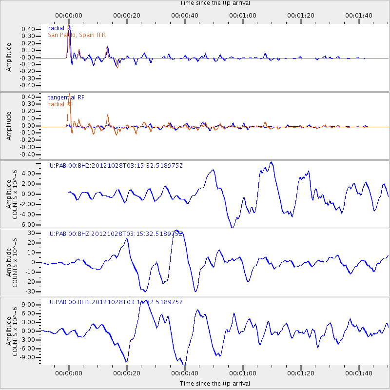
Signal To Noise
| Channel | StoN | STA | LTA |
| IU:PAB:00:BHZ:20121028T03:15:32.518975Z | 5.737425 | 2.4084486E-6 | 4.1977867E-7 |
| IU:PAB:00:BH1:20121028T03:15:32.518975Z | 1.701685 | 1.0225504E-6 | 6.009046E-7 |
| IU:PAB:00:BH2:20121028T03:15:32.518975Z | 1.7628199 | 9.744969E-7 | 5.528057E-7 |
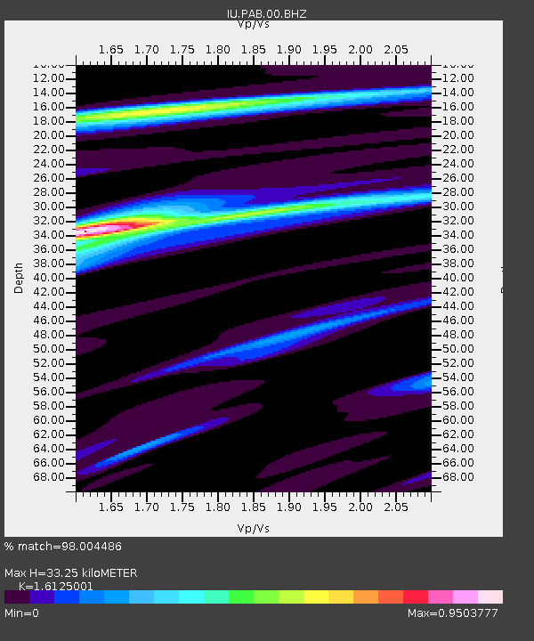
| Arrivals | |
| Ps | 3.4 SECOND |
| PpPs | 13 SECOND |
| PsPs/PpSs | 17 SECOND |

